Rides

Find your next ride.

Every state, every discipline — the rides Australia is talking about.

Canberra
Find a Club

20 ridesof 713

Canberra

Showing rides matching “Canberra” across Australia.
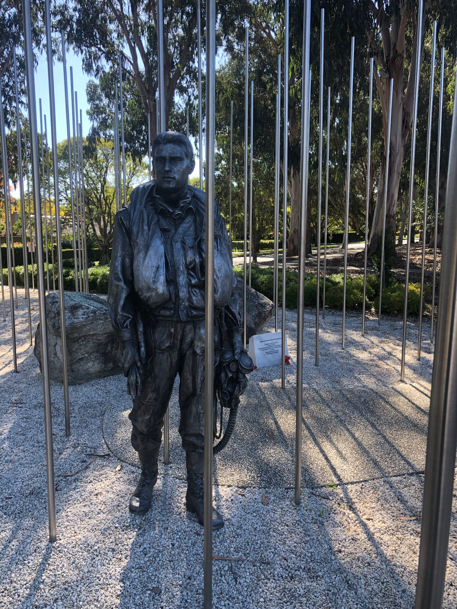
The Canberra Centenary Trail is an epic shared-use loop showcasing the best of the Bush Capital, linking Canberra’s iconic landmarks with nature reserves, forests, rural landscapes and some brilliant off-road riding. The current Parks ACT route is 138km and is divided into seven sections, taking riders past places including Parliament House, Mount Ainslie, Mulligans Flat, Hall Village, Black Mountain, the National Arboretum, Stromlo Forest Park, Kambah Pool and Pine Island. Most of the cycling route is graded green and combines sealed cycle paths, gravel management trails and shared-use singletrack, while the Northern and Southern sections step up to blue intermediate terrain with steeper, rockier sections. Tackle a single section, link a few together or take on the entire loop over around three days for a proper Canberra bikepacking adventure. RTS Tip: Don’t feel like you need to smash out the whole loop — the seven sections make it easy to build a ride around your time and ability. A mountain bike or gravel bike is recommended, and downloading the official ride GPX and offline maps is worthwhile as signage is limited in some areas and mobile reception can be patchy. Carry plenty of water on the more remote sections and check Parks ACT alerts and fire conditions before setting out, particularly on the Northern Link.

138 km1805 mMTB

Swap the highway for fire trails and turn the classic Canberra-to-the-coast trip into a proper bikepacking adventure. This approximately 150km point-to-point route connects Canberra with Batemans Bay on the NSW South Coast, using mostly fire trails with shorter sections of sealed road at the beginning, middle and end. Rather than taking the busy highway over Clyde Mountain, the route heads through the backcountry, delivering a much quieter and far more adventurous way to reach the coast. There are a few ways to tackle it. Riders looking for a more comfortable introduction to bikepacking can split the journey over two days, staying overnight around Araluen and covering roughly 70–80km each day. Those wanting the full bikepacking experience can carry camping gear and spend the night in the bush around Deua National Park, while strong riders looking for a serious challenge can attempt the entire route in a single day. Expect remote fire trails, long stretches through the bush, plenty of climbing and some rougher terrain along the way. Once past Araluen, conditions become more adventurous, so this isn't simply a smooth gravel-road cruise to the beach. There are stretches of around 50km without reliable food or water resupply, along with areas of limited mobile reception, so riders need to be self-sufficient and prepared for changing conditions. And after around 150km of riding, there's a pretty good reward waiting at the other end — rolling into Batemans Bay and reaching the coast by bike. RTS Tip: This is a remote point-to-point adventure, so plan your food, water, overnight gear and return transport before setting off. Carry offline navigation and consider a PLB or satellite communication device. Trail conditions can change considerably after rain, so check current forest, park, road, weather and fire information before leaving. Follow the mapping and route information links for more detail when planning your adventure.

150 kmGravel, Road

The Hunt 1000 is one of Australia's great bikepacking adventures — an epic journey of approximately 1,000km from Canberra to Melbourne through the Australian Alps and Victorian High Country. With more than 23,000 metres of climbing, this is far more than a long gravel ride. The route links remote backcountry roads, gravel tracks, alpine trails and rugged mountain terrain as riders make their way south through some of Australia's most spectacular high-country landscapes. Expect huge climbs, fast gravel, river crossings, rough tracks and sections of hike-a-bike, balanced by incredible riding through snow gum woodlands, open alpine plains and towering native forests. Historic mountain huts and remote high-country communities add another dimension to the journey as the route works its way towards Melbourne. The Hunt 1000 is designed as a self-supported bikepacking route, meaning riders need to carry what they require, manage their own navigation and carefully plan food, water, accommodation or camping and resupply opportunities along the way. While approximately 1,000km is a challenge in itself, it's the 23,000m+ of climbing, remote terrain and unpredictable alpine conditions that make this a serious undertaking. Riders should have strong fitness, solid bikepacking experience and the ability to manage mechanical, navigation and weather challenges far from immediate assistance. The route is traditionally associated with the annual Hunt 1000 gathering, but you don't need to think of it purely as an event. At its heart, this is an incredible Canberra-to-Melbourne bikepacking adventure through the Australian Alps and one of the standout long-distance cycling challenges in Australia. RTS Tip: The exact Hunt 1000 route can change between editions, so don't assume an older GPX represents the current route or access conditions. Use the mapping and official information links when planning your adventure, check current land and trail access, and be prepared for rapidly changing mountain weather and long stretches through remote country.

1000 kmGravel, Road, Trail

The Narrabundah Velodrome, affectionately known to Canberra cyclists as “The Bundahdome”, is an outdoor track cycling venue in Narrabundah, Canberra ACT and an important part of the city’s cycling history. Opened in 1972, the concrete velodrome has hosted more than 50 years of track racing, training, junior development and ACT championship events. Its distinctive steep banking and outdoor setting have helped give the track plenty of character, with generations of Canberra riders learning their craft here. The Bundahdome has produced and developed an impressive list of Australian cyclists, with riders associated with the track including Mathew Hayman, Michael Rogers, Rebecca Wiasak, Nathan Hart, Oenone Wood, Sue Powell and Michael Milton. Hayman went on to famously win Paris–Roubaix in 2016, while the velodrome has continued to provide a pathway from junior cycling through to elite competition. After being closed in 2013 because of concerns about the ageing track surface, the velodrome underwent a major $1.5 million safety upgrade, including resurfacing and improvements to the transitions between the steeply banked bends and straights. It reopened in 2014 and continues to be used for organised track cycling. Today, the Narrabundah Velodrome remains home to track training, junior development and racing, with Vikings Cycling Club ACT running track programs at the venue and the Capital Region Masters Cycling Club holding seasonal racing. Vikings also provides junior track bikes for its development program, making the Bundahdome an excellent place for Canberra riders interested in getting started in track cycling. RTS Tip: The Bundahdome is a proper banked velodrome rather than a casual recreational cycle loop, so don’t simply roll onto the track without understanding track-riding etiquette. Organised sessions are the best way for newcomers to experience it, and track bikes are available through some club programs. The steep banking can be intimidating at first, so learn the correct entry, exit and passing procedures and build your speed and confidence gradually.

0.333 km-35.337738 mTrack

Thirstypacker Threehundo – Canberra Bikepacking Loop The Thirstypacker Threehundo is a huge 300km weekend bikepacking loop from Canberra, crossing the Brindabella Ranges and linking Tumut and Wee Jasper into two seriously rewarding days on the bike. Starting in Canberra, the route quickly leaves the city behind and heads towards the mountains, travelling through an incredible mix of bushland, pastoral country, subalpine forest, remote backroads and rugged gravel. Day one covers approximately 152km with 2,806m of climbing, crossing the Brindabella Ranges on the brilliant Warks Road climb before descending through the Brindabella Valley and continuing towards Tumut. Along the way, riders pass through constantly changing landscapes, from Canberra's urban trails to dense mountain forest, open valleys and remote country roads. After an overnight stop in Tumut, day two delivers another approximately 150km and 2,800m of climbing. The route heads towards Wee Jasper, combining sealed and hard-packed gravel roads with another substantial climb before continuing through the hills and eventually returning to Canberra via Mountain Creek Road. The terrain varies considerably throughout the adventure. Expect everything from bitumen and smooth gravel through to rougher, overgrown tracks, long sustained climbs and fast mountain descents. A capable gravel bike or hardtail mountain bike with 48mm / 2-inch tyres or wider is recommended. This isn't an introductory bikepacking overnighter. Back-to-back 150km days and around 5,600m of total climbing demand strong fitness, while remote sections, limited mobile reception and changing mountain weather mean riders also need to be comfortable travelling self-sufficiently. For experienced riders looking for a big Canberra gravel and bikepacking adventure without committing to a week-long expedition, the Thirstypacker Threehundo packs an enormous amount of riding into one weekend. RTS Tip: Water can be scarce across sections of the route and some natural water sources require treatment, so plan your water carefully. Carry offline navigation, repair equipment, appropriate layers, first aid and emergency communications such as a PLB. Conditions in the Brindabellas can change quickly, so check current weather, fire, forestry and road conditions before setting out.

300 kmBackroads, Trail

Attack of the Buns is a cracking multi-day bikepacking adventure through the Southern Tablelands and Southern Highlands of NSW, travelling approximately 323km from Bungendore to Bundanoon over three to four days. With around 63% of the route unpaved and approximately 4,692m of climbing, it combines quiet gravel backroads, remote fire trails and short sealed sections into a seriously rewarding long-weekend adventure. Despite the slightly intimidating name, this isn't an overly technical route. Much of the riding is along wide gravel roads and car-free fire trails, with some rougher 4WD sections and one particularly steep climb where a little hike-a-bike may be required. The real challenge comes from the distance, climbing and stretches of remote riding rather than technical trail difficulty. The scenery changes constantly along the way, taking riders through dry eucalypt forest, sandy woodland and lush rainforest while crossing several national parks and conservation areas. Highlights include the wild landscapes around Budawang National Park, Red Ground Track, Tianjara Falls, quiet gravel roads towards Kangaroo Valley, Griffins Firetrail and the spectacular waterfalls and escarpment views around Fitzroy Falls. Wildlife spotting is part of the experience too, with wombats, kangaroos, wallabies and lyrebirds all possible along the journey. There are plenty of opportunities for camping along the route, ranging from established campgrounds to remote clearings, making it possible to tackle the ride at different speeds. Riders should plan supplies carefully, however, as there is an extended stretch of around 160km between Braidwood and Nowra without resupply points. Natural water can be found along the route, but filtration or treatment is recommended. The route starts near Canberra at Bungendore and finishes at Bundanoon, roughly halfway between Canberra and Sydney. Public transport options at either end make this a particularly interesting point-to-point bikepacking option, or riders can keep the adventure going towards Sydney and the Blue Mountains. RTS Tip: This is a remote multi-day adventure, so good preparation and navigation are essential. River crossings and trail conditions can change considerably following rain, and riders should check current weather, park alerts, closures and fire conditions before setting off. Use the mapping and detailed route information linked below when planning your trip.

323.3 km4692 mGravel

The Boboyan Divide is a scenic 45km gravel and bikepacking adventure through Namadgi National Park, around 45 minutes south of Canberra. Following remote management trails and historic roads, the route passes alpine landscapes, forests and heritage huts, making it an ideal overnight adventure or rewarding day ride. This is a remote, self-supported ride with limited services and mobile reception, so riders should plan carefully and carry appropriate equipment. For detailed route information, GPX files, gear recommendations, camping information and preparation tips, we highly recommend reading the excellent guide in the links from We Are Explorers before heading out.

46 km880 mBike Packing

Bruce Ridge Nature Reserve is a 94-hectare bushland reserve just 5km from Canberra's CBD, offering around 14km of shared cross-country mountain bike trails through native woodland. The network provides fun, flowing riding while showcasing the reserve's rich biodiversity and natural beauty. The trails are the result of a collaboration between the ACT Parks and Conservation Service, Friends of Bruce Ridge, IMBA and the local riding community to create a sustainable trail network that protects sensitive flora, fauna and cultural heritage while providing a safe riding experience. As a protected nature reserve, riders are encouraged to stay on designated trails, respect wildlife and help preserve this unique urban riding destination.

14 kmMTB

Cotter Pines is the latest addition to riding in Canberra and is the result of a collaborative effort between the volunteer-based Kowalski Brothers Trailworks, Iconic Trails, and ACT Government Sport and Recreation. About half an hour from the centre of Canberra, Cotter Pines traverses a 360ha pine plantation, with nearly 19 trails and about 16km of singletrack. The network has a mix of old-school hand-built trails, with a smattering of tight twisty corners, and of course, some machine-built singletrack designed to be railed at speed. Be sure to stop at the Eagle Rock Lounge and take in the view of Stony Creek Reserve. There is a detailed trail map at the start of The Spine trail near the main carpark, and each trail is clearly signposted.

18 kmMTB

The AUA Bike Precinct is an inclusive cycling destination in Canberra, designed to provide a safe and accessible place for riders of all ages and abilities to develop confidence and skills. Developed through a partnership between Abilities Unlimited Australia, the ACT Government and local cycling organisations, the precinct promotes participation, recreation and community connection through cycling. The facility features a purpose-built criterium-style circuit, skills areas and open spaces suitable for recreational riding, coaching, adaptive cycling and community events. Whether you're learning to ride, training or simply enjoying a spin, the precinct offers a welcoming environment for everyone.

BMX

Gravity Eden is a major mountain bike destination in Nullica State Forest just outside Eden on the NSW Sapphire Coast, delivering more than 58km of purpose-built, gravity-fed singletrack from a peak elevation of around 300m. The network has been designed to take advantage of Eden’s dramatic terrain, dropping from rocky forested ridgelines through lush valleys towards the coast and Twofold Bay. Built by specialist trail builders Contour Works, the network features more than 20 trails spanning green, blue and black grades. There’s a strong gravity focus, but this isn’t simply a downhill park — riders will find XC adventures, climbing trails, long traverses, flow descents and technical gravity trails, allowing you to build anything from a short session to a substantial day on the bike. The network is divided into three main riding zones. The Adventure Zone is the gateway to the park and provides easier riding and progression opportunities. The Flow Zone introduces longer descents, berms and faster riding, while the Gravity Zone heads deeper into the forest with the park’s longest and most challenging descents. Some of the standout trails include Garden of Eden, a 2.3km shared-use adventure trail through a fern-filled valley; Gutter Ball, with sweeping berms and rollers; Round the Outside, an 8.4km adventure through varied terrain; and the huge Breath of Fire, a nearly 7km flow descent. More experienced riders can tackle trails such as Prana and Old Tom, where rock gardens, drops, chutes, jumps and steeper terrain turn things up considerably. There’s also a dedicated Skills Park with an asphalt pump track and dirt jump park, giving riders somewhere to warm up, practise features or simply session without heading deep into the network. Gravity Eden is managed by the Eden Mountain Bike Club, which partnered with Forestry Corporation NSW to establish the network on State Forest land. Riding is free, with ongoing trail maintenance funded through the club, sponsors, rider contributions and volunteer trail work. The location makes this one particularly good for a multi-day riding trip. Eden sits roughly halfway between Sydney and Melbourne and around 3.5 hours from Canberra, with beaches, accommodation, cafés and the wider Sapphire Coast right on the doorstep. For riders searching for Gravity Eden MTB, Eden mountain bike trails, Sapphire Coast MTB, South Coast NSW mountain biking or gravity trails in NSW, this is absolutely a destination worth putting on the ride list. RTS Tip: Don’t let the name fool you — you don’t need to be an advanced gravity rider to enjoy Eden. Start in the Adventure Zone and progressively work through Flow before heading deeper into the Gravity Zone. With 58km+ to explore, this is also one worth allowing a full day or, even better, building into a riding weekend. Check live trail status before setting out, particularly after significant rain, high winds or bushfire conditions

58 kmMTB

Jerrabomberra MTB Trails – Queanbeyan (Jerra Trails) The MTB trails around Jerrabomberra Mountain Reserve offer a surprisingly extensive pocket of natural mountain biking just outside Canberra and Queanbeyan, with singletrack spread across the slopes of Mount Jerrabomberra in southern NSW. Often simply called “Jerra” by local riders, the area is characterised by hand-built and natural-style singletrack rather than the manicured feel of a major trail centre. Expect rocky sections, tight turns, short punchy climbs, flowing descents and plenty of technical features, with the terrain making good use of the hill’s elevation. Popular mapped trails and loops include Pipeline, Swoop, Lazy Dog, Playschool and Neanderthal, with various connections allowing riders to piece together anything from a quick lap to a longer exploration of the reserve. Some routes are also shared with walkers, so riders need to keep an eye out for other trail users. Climbing towards the top of Mount Jerrabomberra is rewarded with impressive views across Queanbeyan, Canberra and the surrounding ranges. The official lookout and management-road network provides another way to explore the reserve and makes a handy reference point when navigating the area. Its location makes Jerra a great addition to a Canberra MTB trip, particularly for riders already exploring the region’s bigger riding destinations. For riders searching for Jerrabomberra mountain bike trails, Jerra MTB, mountain biking in Queanbeyan, MTB trails near Canberra or mountain biking in southern NSW, this local network is definitely worth having on the ride list. RTS Tip: Jerrabomberra is best treated as a local natural trail network rather than a formal purpose-built bike park. Use current trail mapping to work out individual trails, grades and connections before heading out, be considerate of walkers on shared trails and respect any current signage, closures or access restrictions.

MTB

Majura Pines is one of Canberra’s classic mountain bike destinations, packing a great variety of riding into a compact trail network just minutes from the city. Purpose-built singletrack winds through the pine forest with everything from smooth, flowing trails and berms to jumps, technical features and more challenging descending. With trails catering for a range of abilities and plenty of options for linking together laps, Majura is equally suited to newer riders building confidence and experienced riders looking for a fast, fun session. RTS Tip: Majura is perfect for repeat laps, so use your first run to learn the trail and features before adding speed. The network is within a working pine plantation, meaning forestry operations can occasionally affect access — always check current trail closures and conditions before heading out.

20 kmMTB

Melba BMX Track is a local riding spot in Canberra’s north, offering a classic BMX-style track with a series of rollers, jumps and berms to ride and session. Its compact layout makes it ideal for younger riders, families and anyone wanting to practise pumping, cornering and general bike-handling skills without heading to a larger trail network. Whether you’re on a BMX, mountain bike or kids’ bike, it’s an easy place to squeeze in a quick ride and build confidence on two wheels. RTS Tip: Rather than pedalling hard everywhere, practise generating speed by pumping through the rollers and carrying your momentum into the berms. Take an easy lap first to check the condition of the track and features, particularly after wet weather.

BMX

Molonglo Pines and Zoo Pines form part of Canberra’s extensive collection of informal and established mountain bike riding areas, offering a mix of singletrack, fire trails and technical bush riding close to the city. The terrain delivers plenty of variety, with short climbs, flowing sections, rocky features and tighter trails that make the area fun to explore on an XC or trail bike. With multiple tracks and connections through the surrounding landscape, riders can piece together anything from a quick session to a longer exploratory ride. RTS Tip: Trail layouts and access around Molonglo and Zoo Pines can change, so don’t rely on an old route alone. Check the latest local trail information before riding, keep an eye out for closures or changed access, and download a current map if you’re planning to explore beyond the main trails.

20 kmMTB

The National Arboretum Canberra, just 6 km from Canberra’s city centre, offers more than 20 km of multi-use cycling and walking tracks across its spectacular 250-hectare landscape. Rather than a traditional purpose-built MTB park, the Arboretum provides a mixture of unsealed tracks, management trails, shared-use paths and connecting singletrack, weaving between forests containing more than 40,000 rare, endangered and culturally significant trees. Rolling hills and some surprisingly steep gradients add a decent workout, while elevated sections provide brilliant views across Lake Burley Griffin, Canberra, Black Mountain and the surrounding ranges. One of the biggest attractions for mountain bikers is the Canberra Centenary Trail, which passes directly through the Arboretum as part of the section linking Black Mountain with Stromlo Forest Park. For cyclists, this section combines formed cycle paths, wide management trails and shared-use singletrack, with roots, rocks, logs and some short steep sections adding interest. The Centenary Trail is primarily maintained as a green/easy MTB route, making it suitable for riders with basic off-road skills, mountain bikes, e-MTBs and capable gravel bikes. Within the Arboretum itself, riders can explore the designated unsealed tracks and roads or use the area as part of a much larger Canberra MTB ride. The Bicentennial National Trail also passes through the site, while connections towards Stromlo Forest Park, Black Mountain and Stromlo Pines make the Arboretum an excellent link between some of Canberra’s major riding areas. The Arboretum is particularly good for riders looking for scenic, less-technical mountain biking close to central Canberra. You can combine forest tracks with climbs towards Dairy Farmers Hill, explore the southern forests or simply build your own loop through the designated cycling network before stopping at the Village Centre. RTS Tip: This is a shared-use trail network rather than a dedicated MTB park, so ride accordingly. Cyclists must give way to horses, walkers and runners, and there is a 10 km/h speed limit on shared tracks and trails. Download the Arboretum trail map before setting out and stick to designated cycling routes. For a bigger adventure, use the Canberra Centenary Trail to link the National Arboretum with Stromlo Forest Park and turn a relaxed forest ride into a much longer Canberra MTB mission.

20 kmMTB

Seiffert Oval Cycle Track – Queanbeyan The cycling track at Seiffert Oval is an outdoor 400-metre bitumen cycle track in Queanbeyan East, NSW, providing a dedicated venue for cycling training, competition and casual riding. Located at 36 Thurralilly Street, the track circles the sporting field at Seiffert Oval, a well-known Queanbeyan sporting venue. Unlike a steeply banked competition velodrome, its longer outdoor layout makes it useful for training, fitness riding and local cycling events, as well as general community cycling. The cycle track has historically been used by local cycling clubs for competition and training and has also hosted cycling events attracting riders from across NSW. The precinct has lighting suitable for cycling events, allowing organised riding to continue into the evening. Seiffert Oval itself has an interesting sporting history and was once the home ground of the Canberra Raiders, but its connection with cycling goes even further: the oval was named after John Wesley Seiffert, who was himself a successful amateur cyclist and won a one-mile amateur track cycling championship in 1926. For riders searching for Queanbeyan Velodrome, Seiffert Oval cycling track, track cycling near Canberra or outdoor cycling tracks in southern NSW, Seiffert Oval is a useful local cycling facility to have on the ride list. RTS Tip: Council documentation has previously noted that the bitumen track surface was ageing and in need of substantial renewal, so I wouldn’t make strong claims about its current riding condition. Check the surface and current access when you arrive, particularly before higher-speed training.

0.4 km34.751539 mTrack

Sparrow Hill and East Kowen form one of Canberra’s largest and most rewarding mountain bike networks, with the two areas linked to create plenty of options for anything from a quick spin to a big day on the bike. Expect kilometres of purpose-built singletrack weaving through pine forest and native bush, with flowing sections, punchy climbs, technical features and fast descents. The extensive network means riders can build loops to suit their distance and ability, making it a favourite for XC and trail riders who enjoy covering ground and exploring. RTS Tip: With so many trail junctions and loop options, it’s worth having your route sorted before you roll out — especially if you’re linking Sparrow Hill and East Kowen into one longer ride. Forestry operations and events can also affect access, so check current trail conditions and closures before heading out.

60 kmMTB

Stromlo Forest Park is Canberra’s flagship mountain biking destination and one of Australia’s best-known purpose-built MTB parks. Located around 15 minutes from Canberra’s city centre, the 1,200-hectare multi-sport precinct offers more than 50km of professionally built and maintained mountain bike trails, catering for everyone from first-time riders through to experienced XC, enduro and downhill riders. The network has a huge variety of riding, with green, blue and black trails spread across Mount Stromlo. Expect flowing singletrack, technical rock features, berms, jumps, drops, natural obstacles and long descents, alongside dedicated climbing trails that allow riders to pedal their way back up for another run. Stromlo has a particularly strong cross-country heritage, having hosted the 2009 UCI Mountain Bike World Championships. Today there’s an extensive XC network where riders can link trails together into anything from a short beginner loop to a substantial ride around the mountain. Gravity riders are equally well catered for, with dedicated downhill and jump trails descending from the upper mountain. Popular trails across the wider network include Luge, Pork Barrel, Old Duffy Descent and Trebuchet, with everything from fast flow to serious technical terrain. Current Trailforks mapping shows more than 100 individual MTB trail sections across the broader park. One of Stromlo’s biggest advantages is the shuttle service, allowing riders to maximise their descending rather than climbing for every lap. The official shuttle currently operates Friday to Sunday, on public holidays and during ACT school holidays, generally taking riders to the top of the mountain every 40 minutes. There’s also plenty for riders developing their skills. Stromlo has the Evolution Coaching Trails, The Playground and a pump track, providing dedicated areas to practise cornering, jumping and technical features before taking those skills onto the mountain. Adaptive riders are well catered for too, with current mapping identifying more than 20 adaptive-accessible trail sections, adding to Stromlo’s appeal as a genuinely broad cycling destination. The main precinct includes parking, an event pavilion and nearby café/bar and bike hire, while the park also features a 1.2km criterium circuit and other cycling and recreation facilities. For riders searching for Stromlo MTB, Canberra mountain bike trails, Mount Stromlo MTB, downhill MTB Canberra or ACT mountain biking, this is the region’s must-know destination and easily worth building an entire day of riding around. RTS Tip: Stromlo is big enough that it pays to plan your ride around your ability and preferred style rather than trying to cover everything. Newer riders can stick to the green loops and progression areas, trail riders can build a big pedal-powered adventure, while gravity riders can grab a shuttle pass and concentrate on the descents. All designated MTB trails are one-way, and individual trails can close for maintenance, events or weather, so check the official trail status before riding.

Recommended by 1 rider
50 kmMTB

Unsanctioned trails - Tuggeranong Pines offers a compact network of mountain bike trails in Canberra’s south, with purpose-built singletrack winding through the pine forest and surrounding terrain. The network packs plenty of variety into a relatively small area, with flowing sections, berms, climbs, technical features and faster descents making it a fun option for XC and trail riders. Its interconnected trails make it easy to string together different loops, session favourite sections or add extra laps for a longer ride. RTS Tip: Tuggeranong Pines is a great place to practise skills and repeat sections, so take an easier lap first and then build up your speed as you learn the trails. As the network sits within an active plantation area, forestry operations can affect trail access — check current closures and conditions before you ride.

5 kmMTB

Outside your filter

Also trending right now

Dungog MTB Park, set within the 650-acre Dungog Common on the western edge of Dungog, has become one of the Hunter region’s standout mountain biking destinations. The Common offers over 30km of singletrack, with trails ranging from easy beginner riding through to difficult technical terrain, plus two purpose-built flow tracks and a fun track. The network rolls through open countryside and forested hills, combining cross-country singletrack, climbs, fast descents and plenty of opportunities to build skills. The trails are managed and maintained by the volunteer-run Ride Dungog, making this a genuine community-built riding destination within easy reach of Newcastle and the Central Coast. RTS Tip: Give yourself plenty of time here — between the XC network, flow tracks and pump/fun track, it’s easy to spend a full day riding. Check the current trail status with Ride Dungog before heading out, particularly after rain. Shuttle services also operate on many weekends and selected holiday periods if you’d rather save your legs and maximise your descending laps.

30 km420 mMTB

Tathra MTB Park’s Bundadung Trail Network is the heart of mountain biking in Tathra on the NSW Sapphire Coast, delivering classic hand-built cross-country singletrack through coastal eucalypt forest just minutes from the beach. Tathra has established itself as one of NSW’s premier MTB towns, with the wider network offering around 50–55km of singletrack and more than 40 trails. Bundadung is the main northern trail network and the birthplace of Tathra’s XC riding scene. Expect plenty of climbing followed by rewarding descents, with tight hand-built singletrack, rocks, log rollovers, gully crossings and natural technical features rather than heavily manicured bike-park terrain. The elevated sections also deliver glimpses out towards the coast and Tathra Beach. The broader Tathra network caters for children and beginners through to experienced riders, so there’s plenty of opportunity to build confidence before tackling the more demanding sections. Bundadung can also be linked with Tathra’s other riding areas, including the Fire Shed trails, creating much longer XC adventures. One of Tathra’s biggest strengths is just how easy it is to ride from town. The main trailhead is near Tathra Beach Country Club, roughly 1km north of the township, while the Mogareeka Cycle and Walkway provides another connection into the MTB network via Katung Road. The trails are very much a community-built network, and that hand-built character is part of the appeal. Rather than huge jumps and gravity lines, Tathra is about linking kilometres of natural singletrack together, exploring the forest and enjoying a proper old-school XC ride in a spectacular coastal setting. There’s also a Mountain Bike Skills Park at Tathra Country Club, giving kids and developing riders somewhere to practise skills in a controlled environment before heading deeper into Bundadung. For riders searching for Tathra MTB, Bundadung MTB Trails, Sapphire Coast mountain biking, South Coast NSW MTB or cross-country mountain biking near Bega, this is one of the region’s must-ride networks. RTS Tip: Tathra is a great contrast to the newer gravity-focused destinations farther down the Sapphire Coast. Think hand-built XC, natural features and lots of linking singletrack rather than a modern shuttle park. With Gravity Eden to the south and Narooma to the north, Tathra also fits brilliantly into a multi-day South Coast MTB road trip.

50 km780 mMTB

Editor's picks

More rides worth saving

Dungog MTB Park, set within the 650-acre Dungog Common on the western edge of Dungog, has become one of the Hunter region’s standout mountain biking destinations. The Common offers over 30km of singletrack, with trails ranging from easy beginner riding through to difficult technical terrain, plus two purpose-built flow tracks and a fun track. The network rolls through open countryside and forested hills, combining cross-country singletrack, climbs, fast descents and plenty of opportunities to build skills. The trails are managed and maintained by the volunteer-run Ride Dungog, making this a genuine community-built riding destination within easy reach of Newcastle and the Central Coast. RTS Tip: Give yourself plenty of time here — between the XC network, flow tracks and pump/fun track, it’s easy to spend a full day riding. Check the current trail status with Ride Dungog before heading out, particularly after rain. Shuttle services also operate on many weekends and selected holiday periods if you’d rather save your legs and maximise your descending laps.
30 km420 mMTB

Knapsack MTB Trails – Glenbrook Knapsack Reserve is one of the Lower Blue Mountains’ key sanctioned mountain bike areas, sitting at Glenbrook/Lapstone on the eastern escarpment. The reserve combines purpose-built MTB singletrack and a dedicated downhill trail (Stringline Knapsack DH) with historic fire trails and old railway infrastructure, all within easy reach of Western Sydney. Ride Blue Mountains describes Knapsack as having the longest sanctioned MTB trail and the only sanctioned downhill trail in the Blue Mountains. The riding has a distinctly old-school Blue Mountains character. Expect sandstone, rocks, roots, tight natural singletrack, technical sections and plenty of elevation change as trails work their way down the escarpment. The downhill trail provides the more gravity-focused option, while the surrounding trails allow riders to put together shorter XC and trail-style sessions. One of the great things about Knapsack is the setting. The reserve contains remnants of the historic Lapstone Zig Zag railway, including cuttings and the spectacular sandstone Knapsack Viaduct, built in 1867 as part of the original railway crossing of the Blue Mountains. This gives the area a mix of MTB, bushland and railway history that’s pretty unique. Knapsack is also brilliantly positioned for a bigger day on the bike. Nearby Glenbrook provides access to the famous Woodford–Oaks Trail, including its purpose-built technical singletrack section, while Bennetts Ridge and other authorised riding in the Glenbrook area provide plenty of opportunities to extend the adventure. The main reserve access is from Barnet Street, Glenbrook, and the location is relatively easy to reach from Glenbrook and Lapstone stations. For riders searching for Knapsack MTB, Glenbrook mountain bike trails, Blue Mountains MTB, downhill mountain biking near Sydney or mountain biking in the Lower Blue Mountains, Knapsack is an important local network to have on the ride list. RTS Tip: Knapsack is one where current mapping is worth having with you. Ride Blue Mountains notes that signage can be poor and the return route from the downhill trail isn’t particularly obvious until you know the network. There are also many unsanctioned trails elsewhere in the Blue Mountains, so stick to the recognised Knapsack trails rather than assuming every piece of visible singletrack is legitimate.

Verified by 4 ridersRecommended by 2 riders
12 km260 mMTB, XC

Tathra MTB Park’s Bundadung Trail Network is the heart of mountain biking in Tathra on the NSW Sapphire Coast, delivering classic hand-built cross-country singletrack through coastal eucalypt forest just minutes from the beach. Tathra has established itself as one of NSW’s premier MTB towns, with the wider network offering around 50–55km of singletrack and more than 40 trails. Bundadung is the main northern trail network and the birthplace of Tathra’s XC riding scene. Expect plenty of climbing followed by rewarding descents, with tight hand-built singletrack, rocks, log rollovers, gully crossings and natural technical features rather than heavily manicured bike-park terrain. The elevated sections also deliver glimpses out towards the coast and Tathra Beach. The broader Tathra network caters for children and beginners through to experienced riders, so there’s plenty of opportunity to build confidence before tackling the more demanding sections. Bundadung can also be linked with Tathra’s other riding areas, including the Fire Shed trails, creating much longer XC adventures. One of Tathra’s biggest strengths is just how easy it is to ride from town. The main trailhead is near Tathra Beach Country Club, roughly 1km north of the township, while the Mogareeka Cycle and Walkway provides another connection into the MTB network via Katung Road. The trails are very much a community-built network, and that hand-built character is part of the appeal. Rather than huge jumps and gravity lines, Tathra is about linking kilometres of natural singletrack together, exploring the forest and enjoying a proper old-school XC ride in a spectacular coastal setting. There’s also a Mountain Bike Skills Park at Tathra Country Club, giving kids and developing riders somewhere to practise skills in a controlled environment before heading deeper into Bundadung. For riders searching for Tathra MTB, Bundadung MTB Trails, Sapphire Coast mountain biking, South Coast NSW MTB or cross-country mountain biking near Bega, this is one of the region’s must-ride networks. RTS Tip: Tathra is a great contrast to the newer gravity-focused destinations farther down the Sapphire Coast. Think hand-built XC, natural features and lots of linking singletrack rather than a modern shuttle park. With Gravity Eden to the south and Narooma to the north, Tathra also fits brilliantly into a multi-day South Coast MTB road trip.

50 km780 mMTB