Rides

Find your next ride.

Every state, every discipline — the rides Australia is talking about.

Goulburn
Find a Club

8 ridesof 713

Goulburn

Showing rides matching “Goulburn” across Australia.
The Dookie Rail Trail is a short and scenic 8km sealed rail trail through the rolling farmland of Victoria’s Goulburn Valley. Extending both east and west from the small town of Dookie, the trail follows the former railway corridor through classic agricultural country, with expansive views towards Mt Major, Mt Saddleback and Gentle Annie. The flat chip-seal surface and gentle gradients make it an easy ride for families, recreational cyclists and anyone looking for a relaxed spin through the countryside. The trail runs around 3km west from Dookie to Conway Road and 5km east towards Yabba South, passing interpretive signage and examples of Dookie’s portable silo art along the way. The landscape changes beautifully with the seasons, from bright yellow canola fields in spring to hay bales and the region’s distinctive red volcanic soils later in the year. RTS Tip: Dookie makes the perfect base for this ride, with parking, toilets and play equipment available around the CWA Gardens. Ride both sides of town for the full experience, or combine the rail trail with a visit to nearby Mt Major if you’re looking to add some mountain biking to your day. Spring is particularly spectacular when the surrounding canola fields are in flower.

11 kmGravel

The Great Victorian Rail Trail is one of Australia’s great long-distance rail-trail adventures, stretching 134km through Victoria’s High Country from Tallarook to Mansfield, with a 13km branch from Cathkin to Alexandra. The compacted gravel and granitic-sand trail follows the former railway through the beautiful Goulburn River and Trawool valleys, linking towns including Yea, Yarck, Bonnie Doon and Mansfield. Highlights include the historic 201m Cheviot Tunnel, Yea Wetlands, sweeping farmland and the spectacular crossing of Lake Eildon at Bonnie Doon, with Mount Buller and the High Country forming the backdrop as you approach Mansfield. Mostly gentle railway gradients make it accessible for recreational riders, while the distance and trail towns make it perfect for a multi-day gravel or touring adventure. RTS Tip: Check the current trail status before planning your ride. The January 2026 bushfires caused significant damage and, as of the latest official update, the trail is not currently continuous. Open riding includes Tallarook through Yea to the Cheviot Tunnel, Merton to Mansfield, and a short section from Alexandra to Maintongoon Road, while several central sections remain closed with no through-detour available. If you’re looking for an easy ride while recovery continues, the 18km return Yea–Cheviot Tunnel trip is a great option.

134 kmGravel

Mount Major MTB Park at Dookie, around 30 km east of Shepparton in Victoria’s Goulburn Valley, is a purpose-built mountain biking area offering both cross-country and downhill riding across the rocky slopes of Mount Major. The network ranges from easier XC riding through to very difficult gravity trails, with natural singletrack, rock gardens, log crossings, steep climbs, fast descents and technical rocky outcrops. The main Cross Country course is around 10 km, while the mountain also features several shorter downhill runs dropping from near the summit. The easier Melon Track runs for around 1.5 km with flowing open corners and a gully crossing, while the much harder East and Skyline tracks descend for approximately 1.3 km across rocky terrain, off-camber sections and technical outcrops. Mount Major has also hosted high-level competition, including the 2011 Australian Mountain Bike Championships, giving this relatively compact regional Victorian MTB park a strong racing history. The climb to Mount Major’s summit is part of the experience, with the peak reaching around 381 metres above sea level and providing sweeping views over Dookie, surrounding farmland and the Goulburn Valley. The MTB park is located on land associated with the University of Melbourne’s Dookie agricultural campus and remains part of a working farm, so riders may encounter livestock as well as vehicles using Mount Major TV Road to access communications infrastructure. RTS Tip: Mount Major has everything from approachable XC to genuinely difficult rocky descending, so check the trail grading before dropping into an unfamiliar line. Access is via Mount Major TV Road, and cyclists may need to lift their bike over the access gate. Remember you’re riding through a working agricultural property — watch for livestock, road crossings, snakes during warmer months and seasonal magpies, and dogs, camping and fires are not permitted.

MTB

Seiffert Oval Cycle Track – Queanbeyan The cycling track at Seiffert Oval is an outdoor 400-metre bitumen cycle track in Queanbeyan East, NSW, providing a dedicated venue for cycling training, competition and casual riding. Located at 36 Thurralilly Street, the track circles the sporting field at Seiffert Oval, a well-known Queanbeyan sporting venue. Unlike a steeply banked competition velodrome, its longer outdoor layout makes it useful for training, fitness riding and local cycling events, as well as general community cycling. The cycle track has historically been used by local cycling clubs for competition and training and has also hosted cycling events attracting riders from across NSW. The precinct has lighting suitable for cycling events, allowing organised riding to continue into the evening. Seiffert Oval itself has an interesting sporting history and was once the home ground of the Canberra Raiders, but its connection with cycling goes even further: the oval was named after John Wesley Seiffert, who was himself a successful amateur cyclist and won a one-mile amateur track cycling championship in 1926. For riders searching for Queanbeyan Velodrome, Seiffert Oval cycling track, track cycling near Canberra or outdoor cycling tracks in southern NSW, Seiffert Oval is a useful local cycling facility to have on the ride list. RTS Tip: Council documentation has previously noted that the bitumen track surface was ageing and in need of substantial renewal, so I wouldn’t make strong claims about its current riding condition. Check the surface and current access when you arrive, particularly before higher-speed training.

0.4 km34.751539 mTrack

The Stanhope – Girgarre Rail Trail is a short and easy 5 km shared cycling and walking trail in northern Victoria’s Campaspe region, connecting the small rural towns of Stanhope and Girgarre. Following the former Rushworth–Girgarre railway corridor through classic Goulburn Valley dairy country, the trail is almost completely flat and has a light sandy-gravel surface. It’s well suited to mountain bikes, gravel bikes, hybrids, touring bikes and families, and at only around 10 km return makes an approachable ride for almost any ability. Starting from Stanhope Park on the northern edge of Stanhope, the trail heads north through open farmland and increasingly established native plantings. The route is wonderfully straightforward, with long, straight sections following the old railway formation. Several irrigation channels cross the corridor along the way; some retain narrow bridges while others require short gravel-road diversions where the original railway bridges have been removed. Approaching Girgarre, riders can make a worthwhile stop at the Gargarro Botanic Garden, showcasing indigenous plants from the Campaspe region and providing a café for a mid-ride break. The trail then continues into Progress Park, on the site of the former Girgarre railway station, where quirky musical installations including tubular bells reflect the town’s strong community and arts focus. The railway itself dates back to 1917, when the branch line from Rushworth to Girgarre opened to service the surrounding agricultural district. The section beyond Stanhope closed in 1975, with the remaining railway shutting in 1987. Development of the rail trail has been driven largely by the local community and Landcare volunteers, with the first 2 km completed in 2015 and the connection through to Stanhope finished in 2022. There are bigger ambitions for the corridor. The community’s long-term plan is to extend the trail south from Stanhope towards Rushworth, where it could eventually connect with the newer Waranga Rail Trail, creating a much more substantial regional cycling route. RTS Tip: This is an ideal easy 10 km out-and-back ride. Start in Stanhope, ride north to Girgarre and stop at the Gargarro Botanic Garden and café before heading back. The trail is flat, but the light sandy gravel can be a little loose and narrow in places, so wider tyres will make the ride more comfortable. If you're visiting on the second Sunday of the month, time your ride with the Girgarre Farmers Produce and Craft Market for an even better reason to linger at the turnaround point

19 kmGravel

The Waranga Rail Trail is a 19 km shared cycling and walking trail connecting Murchison and Rushworth in northern Victoria. Fully completed in 2025, it follows the former railway corridor through Box-Ironbark country, farmland, wetlands and the Waranga Basin landscape. With an almost level gradient and a combination of fine gravel and asphalt, it’s an excellent option for families, gravel bikes, mountain bikes, hybrids and recreational riders. The trail begins at Impey Street in Murchison and heads west towards Rushworth. Along the way it passes Doctors Swamp Wildlife Reserve, an important wetland habitat, and crosses numerous irrigation channels associated with the enormous Waranga Basin. One of the highlights is the restored historic bridge across the Stuart Murray Canal, along with several other former railway bridges incorporated into the route. Most of the trail has a fine-gravel surface, while the final kilometre approaching Rushworth is smooth asphalt through the former railway yard. The route is generally easy, although riders need to take care at two crossings of the Murchison–Rushworth Road. Both Murchison and Rushworth have toilets, picnic facilities and plenty of options for a post-ride bakery or café stop. The railway originally opened between Murchison East and Rushworth in 1890, later extending to Colbinabbin, with Rushworth becoming a junction when the branch towards Girgarre opened in 1917. Part of the railway had to be diverted when Waranga Basin was constructed in 1905, and the various lines eventually closed by 1987. The first 8 km between Murchison and Channel Inlet Road opened in 2015, before the remaining 11 km to Rushworth was completed a decade later. The finished Waranga Rail Trail opened to riders on 1 April 2025 and was officially opened on 17 May 2025, finally creating the continuous 19 km route. There are also exciting possibilities for future connections. Plans have been discussed to extend the Stanhope–Girgarre Rail Trail south towards Rushworth, while a future Murchison–Heathcote connection could eventually link Waranga with the O’Keefe Rail Trail. RTS Tip: The full Murchison–Rushworth return ride is around 38 km, but the flat railway gradient makes it a very achievable longer recreational ride. For something shorter, ride from either town towards Waranga Basin and return. Gravel or wider hybrid tyres are ideal for the mostly fine-gravel surface. If you're arriving by train at Murchison East, be aware that the connection into Murchison isn't entirely traffic-free and includes a busy road crossing and the Goulburn River bridge, where riders need to dismount.

19 kmGravel

Brauman Street/Packham Street BMX Track – Shepparton Brauman Street in Shepparton is home to the Shepparton BMX Club, one of regional Victoria's established BMX racing facilities and part of the wider Shepparton Sports City cycling precinct. The purpose-built outdoor BMX track provides the jumps, rollers, straights and banked turns that make BMX racing such a fast and exciting discipline, supporting everything from club training and racing through to major competition. Shepparton has a particularly strong BMX history. The venue has produced riders who have competed on the world stage and has previously hosted major events including the UCI BMX Supercross World Cup, bringing international-level BMX racing to regional Victoria. The BMX track sits within a significant cycling precinct alongside the Shepparton Velodrome, making this a great location for riders interested in both BMX and track cycling. Whether you're searching for BMX riding in Shepparton, Shepparton BMX Club, BMX tracks in regional Victoria or cycling facilities in the Goulburn Valley, Brauman Street is an important part of the local riding scene. RTS Tip: As an active BMX club and racing facility, track access may vary around organised training, racing and events. Check current Shepparton BMX Club information before making a special trip and respect any organised activities taking place at the track.

BMX

Wingello Forest Trails are an established mountain bike network in Wingello State Forest in the NSW Southern Highlands, around halfway between Moss Vale and Goulburn. The forest combines pine plantation and native bushland with purpose-built singletrack, fire roads and forest tracks, making it a great destination for cross-country and trail riding. The traditional Wingello network is built around three marked routes. The Blue Trail is around 7km, following formed roads and fire trails through the pine plantation. The Yellow Trail is around 18km, extending through both pine plantation and native forest. The Red Trail was around 22km, mixing fire roads with more challenging sections of singletrack. There’s also a substantial collection of dedicated singletrack, with trails including Princesses Revenge, Genesis, Everglades, Flinging Scotsman, Cover Shot and Tangles. The riding ranges from approachable flowing trail through to more technical XC terrain, with plenty of opportunities to link individual sections into longer loops. The network has undergone significant redevelopment in recent years. Highlands Trails works closely with Forestry Corporation NSW to manage and care for the Wingello trails, with the first stage of the renewed Wingello Forest Trails officially opening in 2023 and further development planned over time. The Wingello State Forest campground makes this an especially good option for a riding weekend. Camping and trail access are free, with toilets, picnic facilities, parking and a children's nature playground available within the forest. For riders searching for Wingello MTB, Southern Highlands mountain bike trails, Wingello State Forest cycling or cross-country MTB south of Sydney, this is a long-established riding destination with plenty of scope to build anything from a short family ride to a much bigger XC adventure. RTS Tip: Use current trail mapping rather than relying solely on the traditional Blue, Yellow and Red loops. Current Trailforks information indicates that the original Red Loop has changed, with part of the former route permanently closed, while newer singletrack provides alternative riding. As this is a working State Forest, trails can also be affected by forestry operations, so check current access before heading out.

20 kmRoad

Outside your filter

Also trending right now

Dungog MTB Park, set within the 650-acre Dungog Common on the western edge of Dungog, has become one of the Hunter region’s standout mountain biking destinations. The Common offers over 30km of singletrack, with trails ranging from easy beginner riding through to difficult technical terrain, plus two purpose-built flow tracks and a fun track. The network rolls through open countryside and forested hills, combining cross-country singletrack, climbs, fast descents and plenty of opportunities to build skills. The trails are managed and maintained by the volunteer-run Ride Dungog, making this a genuine community-built riding destination within easy reach of Newcastle and the Central Coast. RTS Tip: Give yourself plenty of time here — between the XC network, flow tracks and pump/fun track, it’s easy to spend a full day riding. Check the current trail status with Ride Dungog before heading out, particularly after rain. Shuttle services also operate on many weekends and selected holiday periods if you’d rather save your legs and maximise your descending laps.

30 km420 mMTB

Tathra MTB Park’s Bundadung Trail Network is the heart of mountain biking in Tathra on the NSW Sapphire Coast, delivering classic hand-built cross-country singletrack through coastal eucalypt forest just minutes from the beach. Tathra has established itself as one of NSW’s premier MTB towns, with the wider network offering around 50–55km of singletrack and more than 40 trails. Bundadung is the main northern trail network and the birthplace of Tathra’s XC riding scene. Expect plenty of climbing followed by rewarding descents, with tight hand-built singletrack, rocks, log rollovers, gully crossings and natural technical features rather than heavily manicured bike-park terrain. The elevated sections also deliver glimpses out towards the coast and Tathra Beach. The broader Tathra network caters for children and beginners through to experienced riders, so there’s plenty of opportunity to build confidence before tackling the more demanding sections. Bundadung can also be linked with Tathra’s other riding areas, including the Fire Shed trails, creating much longer XC adventures. One of Tathra’s biggest strengths is just how easy it is to ride from town. The main trailhead is near Tathra Beach Country Club, roughly 1km north of the township, while the Mogareeka Cycle and Walkway provides another connection into the MTB network via Katung Road. The trails are very much a community-built network, and that hand-built character is part of the appeal. Rather than huge jumps and gravity lines, Tathra is about linking kilometres of natural singletrack together, exploring the forest and enjoying a proper old-school XC ride in a spectacular coastal setting. There’s also a Mountain Bike Skills Park at Tathra Country Club, giving kids and developing riders somewhere to practise skills in a controlled environment before heading deeper into Bundadung. For riders searching for Tathra MTB, Bundadung MTB Trails, Sapphire Coast mountain biking, South Coast NSW MTB or cross-country mountain biking near Bega, this is one of the region’s must-ride networks. RTS Tip: Tathra is a great contrast to the newer gravity-focused destinations farther down the Sapphire Coast. Think hand-built XC, natural features and lots of linking singletrack rather than a modern shuttle park. With Gravity Eden to the south and Narooma to the north, Tathra also fits brilliantly into a multi-day South Coast MTB road trip.

50 km780 mMTB

Editor's picks

More rides worth saving

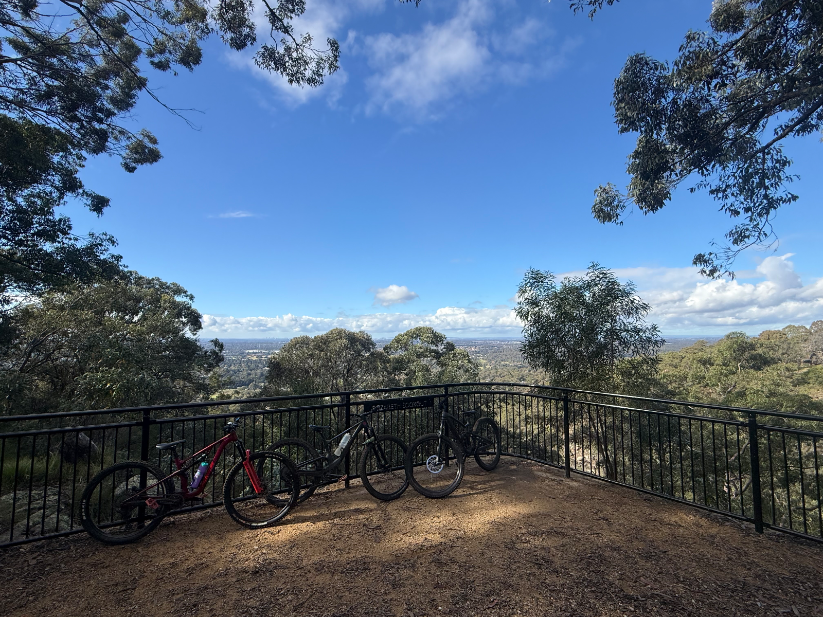
Dungog MTB Park, set within the 650-acre Dungog Common on the western edge of Dungog, has become one of the Hunter region’s standout mountain biking destinations. The Common offers over 30km of singletrack, with trails ranging from easy beginner riding through to difficult technical terrain, plus two purpose-built flow tracks and a fun track. The network rolls through open countryside and forested hills, combining cross-country singletrack, climbs, fast descents and plenty of opportunities to build skills. The trails are managed and maintained by the volunteer-run Ride Dungog, making this a genuine community-built riding destination within easy reach of Newcastle and the Central Coast. RTS Tip: Give yourself plenty of time here — between the XC network, flow tracks and pump/fun track, it’s easy to spend a full day riding. Check the current trail status with Ride Dungog before heading out, particularly after rain. Shuttle services also operate on many weekends and selected holiday periods if you’d rather save your legs and maximise your descending laps.
30 km420 mMTB

Knapsack MTB Trails – Glenbrook Knapsack Reserve is one of the Lower Blue Mountains’ key sanctioned mountain bike areas, sitting at Glenbrook/Lapstone on the eastern escarpment. The reserve combines purpose-built MTB singletrack and a dedicated downhill trail (Stringline Knapsack DH) with historic fire trails and old railway infrastructure, all within easy reach of Western Sydney. Ride Blue Mountains describes Knapsack as having the longest sanctioned MTB trail and the only sanctioned downhill trail in the Blue Mountains. The riding has a distinctly old-school Blue Mountains character. Expect sandstone, rocks, roots, tight natural singletrack, technical sections and plenty of elevation change as trails work their way down the escarpment. The downhill trail provides the more gravity-focused option, while the surrounding trails allow riders to put together shorter XC and trail-style sessions. One of the great things about Knapsack is the setting. The reserve contains remnants of the historic Lapstone Zig Zag railway, including cuttings and the spectacular sandstone Knapsack Viaduct, built in 1867 as part of the original railway crossing of the Blue Mountains. This gives the area a mix of MTB, bushland and railway history that’s pretty unique. Knapsack is also brilliantly positioned for a bigger day on the bike. Nearby Glenbrook provides access to the famous Woodford–Oaks Trail, including its purpose-built technical singletrack section, while Bennetts Ridge and other authorised riding in the Glenbrook area provide plenty of opportunities to extend the adventure. The main reserve access is from Barnet Street, Glenbrook, and the location is relatively easy to reach from Glenbrook and Lapstone stations. For riders searching for Knapsack MTB, Glenbrook mountain bike trails, Blue Mountains MTB, downhill mountain biking near Sydney or mountain biking in the Lower Blue Mountains, Knapsack is an important local network to have on the ride list. RTS Tip: Knapsack is one where current mapping is worth having with you. Ride Blue Mountains notes that signage can be poor and the return route from the downhill trail isn’t particularly obvious until you know the network. There are also many unsanctioned trails elsewhere in the Blue Mountains, so stick to the recognised Knapsack trails rather than assuming every piece of visible singletrack is legitimate.

Verified by 4 ridersRecommended by 2 riders
12 km260 mMTB, XC

Tathra MTB Park’s Bundadung Trail Network is the heart of mountain biking in Tathra on the NSW Sapphire Coast, delivering classic hand-built cross-country singletrack through coastal eucalypt forest just minutes from the beach. Tathra has established itself as one of NSW’s premier MTB towns, with the wider network offering around 50–55km of singletrack and more than 40 trails. Bundadung is the main northern trail network and the birthplace of Tathra’s XC riding scene. Expect plenty of climbing followed by rewarding descents, with tight hand-built singletrack, rocks, log rollovers, gully crossings and natural technical features rather than heavily manicured bike-park terrain. The elevated sections also deliver glimpses out towards the coast and Tathra Beach. The broader Tathra network caters for children and beginners through to experienced riders, so there’s plenty of opportunity to build confidence before tackling the more demanding sections. Bundadung can also be linked with Tathra’s other riding areas, including the Fire Shed trails, creating much longer XC adventures. One of Tathra’s biggest strengths is just how easy it is to ride from town. The main trailhead is near Tathra Beach Country Club, roughly 1km north of the township, while the Mogareeka Cycle and Walkway provides another connection into the MTB network via Katung Road. The trails are very much a community-built network, and that hand-built character is part of the appeal. Rather than huge jumps and gravity lines, Tathra is about linking kilometres of natural singletrack together, exploring the forest and enjoying a proper old-school XC ride in a spectacular coastal setting. There’s also a Mountain Bike Skills Park at Tathra Country Club, giving kids and developing riders somewhere to practise skills in a controlled environment before heading deeper into Bundadung. For riders searching for Tathra MTB, Bundadung MTB Trails, Sapphire Coast mountain biking, South Coast NSW MTB or cross-country mountain biking near Bega, this is one of the region’s must-ride networks. RTS Tip: Tathra is a great contrast to the newer gravity-focused destinations farther down the Sapphire Coast. Think hand-built XC, natural features and lots of linking singletrack rather than a modern shuttle park. With Gravity Eden to the south and Narooma to the north, Tathra also fits brilliantly into a multi-day South Coast MTB road trip.

50 km780 mMTB