Rides

Find your next ride.

Every state, every discipline — the rides Australia is talking about.

Yarra Valley
Find a Club

13 ridesof 713

Yarra Valley

Showing rides matching “Yarra Valley” across Australia.
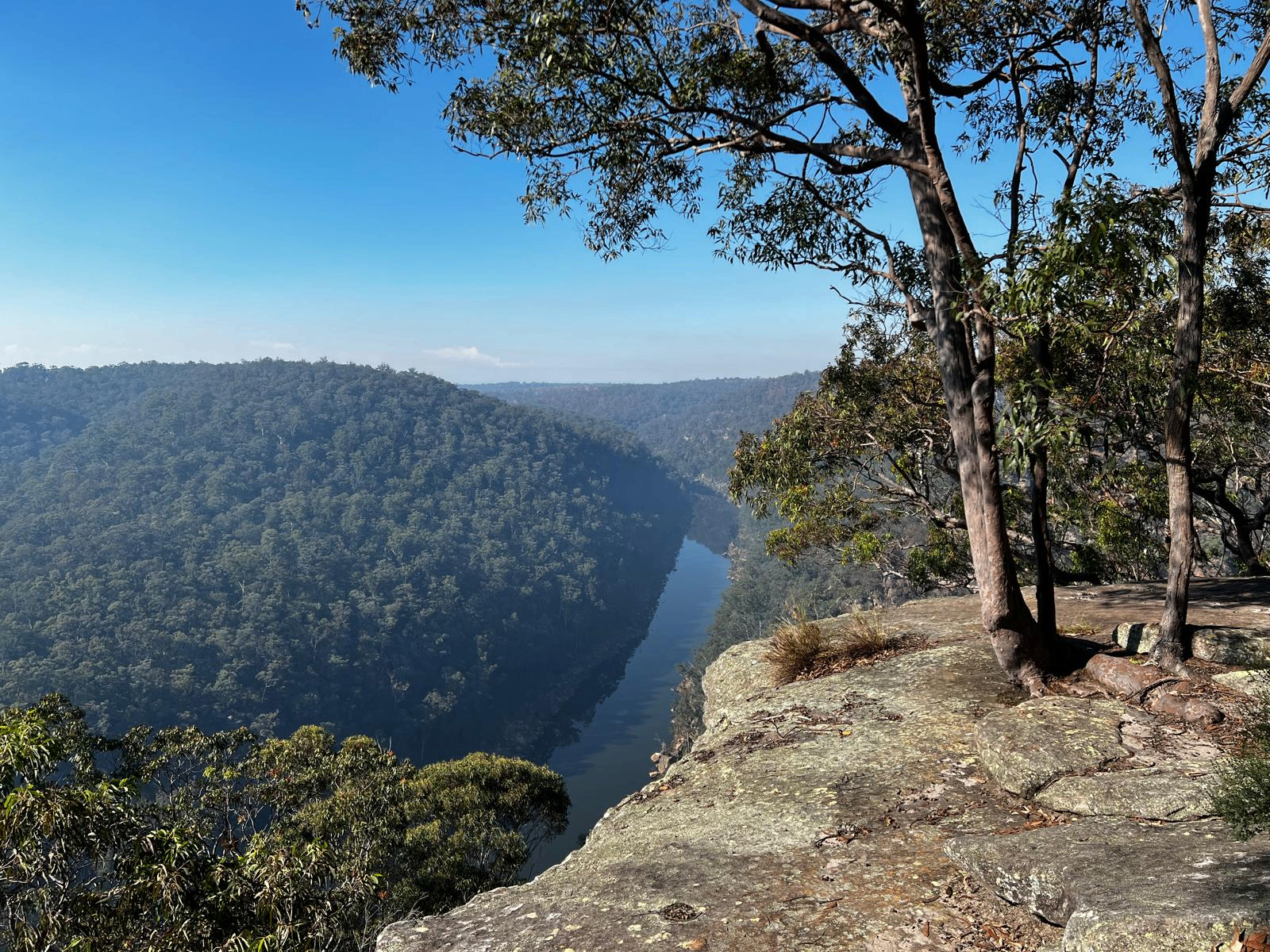
Yarra Valley Gravel Network – Gravel Riding Near Melbourne The Yarra Valley and Yarra Ranges offer an incredible network of gravel roads, forest tracks and cycling trails, making the region one of the best places to explore by gravel bike within easy reach of Melbourne. Rather than one defined route, the Yarra Valley Gravel Network opens up a huge range of riding around Warburton, Yarra Junction, Seville, Healesville and the surrounding ranges. Expect plenty of variety. One ride might take you along smooth gravel through rolling farmland and vineyards, while another can disappear deep into towering mountain ash forest on remote backroads and fire trails. Add some proper climbing into the surrounding ranges and there's enough terrain here to create everything from an easy half-day spin to a seriously challenging gravel adventure. Warburton and the Upper Yarra are particularly good bases for exploring. The Lilydale to Warburton Rail Trail provides an accessible backbone through the valley, while the surrounding forest roads allow riders to branch off into much bigger and more adventurous loops. Head further into the ranges and the terrain becomes steeper and more remote, with gravel routes linking forests, small towns and mountain landscapes around places such as Mount Donna Buang, Healesville and Toolangi. For bikepackers, the network can become even bigger again. Long-distance routes such as the Great Forest Way demonstrate just how easily the gravel roads around the Yarra Valley and surrounding ranges can be linked into a genuine multi-day cycling adventure. Best of all, this huge variety of gravel riding sits remarkably close to Melbourne, making the Yarra Valley a brilliant option for a day trip, cycling weekend or longer gravel escape. RTS Tip: There isn't one single Yarra Valley gravel route — there's a whole network waiting to be explored. Ride The State will continue working on adding the best loops and gravel routes as individual Ride Cards over time. Until then, use the available mapping links to find a route that suits your distance, bike and ability. Forest roads can change considerably with weather, seasonal closures and maintenance, so check current access, fire and road conditions before setting out.

80 kmGravel, Road

The Yarra Valley Trail, in Victoria’s beautiful Yarra Valley east of Melbourne, is a developing shared cycling and walking trail that will eventually connect Lilydale, Yarra Glen and Healesville before linking into the Lilydale–Warburton Rail Trail to create a huge valley-wide cycling network. The currently open section runs for approximately 8.5 km from Lilydale through Coldstream and Yering, following the historic railway corridor across open farmland with sweeping views towards the surrounding Yarra Ranges. Starting from the trail junction near Beresford Road in Lilydale, the route heads north through pasture and scattered bushland towards Coldstream. The former Coldstream Station site provides parking, toilets and a pump track, while a shared path provides access into the township. From there, the trail continues through classic Yarra Valley countryside towards the former Yering Station site. Beyond Yering, riders cross McIntyre Lane before continuing for around 900 m along the old railway embankment. This newer section includes two rebuilt railway bridges and uninterrupted views across the surrounding farmland before reaching the current trail end. The predominantly fine-gravel surface and gentle railway gradients make the route suitable for gravel bikes, mountain bikes, hybrids, e-bikes and recreational riders. The trail follows the former railway towards Yarra Glen and Healesville, which originally opened in 1889. Its future development is particularly exciting: Stage 1 will ultimately extend the trail to Yarra Glen Railway Station, with further stages planned towards Tarrawarra and Healesville. Longer-term plans would connect back into the Lilydale–Warburton Rail Trail around Seville East and Woori Yallock, creating an impressive loop through the wider Yarra Valley. The existing trail is also easy to combine with the Lilydale–Warburton Rail Trail. Both routes split from the same general area in Lilydale, so stronger riders can explore the Yarra Valley Trail towards Yering before returning and continuing towards Mount Evelyn, Wandin, Woori Yallock and Warburton. RTS Tip: The Yarra Valley Trail is still a work in progress, so don’t assume you can currently ride all the way to Yarra Glen or Healesville. For now, an out-and-back from Lilydale to the current trail end beyond Yering gives you roughly 17 km of easy riding, with Coldstream making a handy stop along the way. The route is exposed across sections of farmland, so pack sun protection and water on warmer days. Keep an eye on the trail’s development too — once the planned connections are completed, this will become part of one of Victoria’s most impressive recreational cycling loops

40 kmGravel

The Warburton Rail Trail and Yarra Valley Trail combine for around 48km of riding through Victoria’s spectacular Yarra Valley, starting from Lilydale. The well-established Warburton Rail Trail runs approximately 39km from Lilydale to Warburton, following the former railway through Mount Evelyn, Wandin, Seville, Woori Yallock, Launching Place and Yarra Junction, with a mix of fine gravel and sealed surfaces and generally gentle railway gradients. From Lilydale, riders can also branch onto the developing Yarra Valley Trail, with around 9km currently open towards Yering. Together, the trails offer beautiful riding through farmland, vineyards, forest and river country, backed by views towards the Yarra Ranges. With cafés, wineries and small towns scattered along the route, there are plenty of options for shorter out-and-back rides or a bigger day exploring the valley. RTS Tip: For a classic day out, ride the Warburton Rail Trail from Lilydale all the way to Warburton, or start further along the trail at Woori Yallock or Yarra Junction for a shorter option. Lilydale is accessible by train, making this one of the easier regional Victorian rail trails to reach without a car. Take care at road crossings along the route, particularly those without controlled crossings.

48 kmGravel

Buxton MTB Park is a purpose-built mountain bike network in the Black Range State Forest, around 100km north-east of Melbourne. The park offers around 23km of singletrack across nine trails, with gentle climbs, fast flowing descents, berms, rollers, jumps and sections winding through lush tree ferns. Most of the network is intermediate, with options ranging from the easy 600m Platypus Circuit through to more challenging black trails. The 13.3km Acheron Ridge is the park’s signature loop, combining jumps, berms, log drops and fast singletrack, including the flowing descent through Spider Gully. Other highlights include Off Camber for a shorter dose of flow and airtime, and Cathedral for riders looking for a more technical challenge. All trails are pedal-accessed, one-way and well signed from the main trailhead. RTS Tip: Buxton MTB Park has a seasonal winter closure, generally from the Tuesday after the King’s Birthday weekend in June until the beginning of the September/October school holidays to protect the trails. There’s no drinking water at the trailhead, so bring plenty with you. Toilets, parking, picnic tables and a shelter are available.

20 kmMTB

The Cascades Trail is an epic 30km point-to-point mountain bike adventure dropping from the summit of Lake Mountain to Marysville in Victoria’s High Country. With around 1,550m of descending and 500m of climbing, the trail takes riders through changing alpine environments, from snow gums and granite at the summit to fern-lined forest and valley terrain as you descend towards Marysville. Rated a deep blue/intermediate trail with advanced features, Cascades packs plenty into its 3–5 hour journey, including steep berms, rock gardens, slabs, jumps, rollers, fast sections and some solid climbs. It’s a true adventure ride rather than a cruisy gravity descent, with remote sections and no facilities once you leave the Lake Mountain summit. RTS Tip: This is a directional point-to-point ride, so organise your transport before setting off — either book a bike shuttle from Marysville or arrange your own drop-off at Lake Mountain. Carry plenty of water, food, tools and spares as there are no facilities along the trail, and check seasonal opening and trail conditions before heading up as riding is generally available from November to April, depending on snow.

MTB

Granton DH, near Marysville in Victoria, is an old-school downhill riding area on the slopes around Mount Gordon, built for experienced riders who enjoy steep, natural and technical terrain. The network includes the Granton Downhill Long Track and Granton Downhill Short Track, with the short track dropping around 250m over approximately 1.7km and carrying a double-black rating on Trailforks. Expect steep gradients, rough natural singletrack and a much less manicured experience than a modern bike park. Granton/Narbethong is also recognised as an established downhill riding location in AusCycling’s Victorian Mountain Bike Strategy. RTS Tip: Granton is one for confident gravity riders, not beginners looking for an introduction to downhill. The trails are steep and natural, so inspect unfamiliar sections before committing and come prepared with appropriate protective gear, spares and offline navigation. Trail information and recent condition reports are limited, so check Trailforks and local updates before making a dedicated trip.

MTB

Lake Mountain Alpine Resort, near Marysville in Victoria’s Yarra Ranges, transforms into an alpine mountain biking destination once the snow melts, with trails ranging from beginner-friendly loops to one of Victoria’s standout long-distance MTB descents. Around two hours from Melbourne, riders can explore high-country terrain, snow gum and alpine forest, rocky singletrack and flowing descents, with spectacular views across the surrounding ranges. The headline ride is the Cascades MTB Trail, an approximately 30 km point-to-point descent from Lake Mountain to Marysville. Despite the huge amount of descending, Cascades is a genuine all-mountain adventure rather than a pure downhill run, with pedalling and climbing mixed amongst long flowing descents, rocky sections and more advanced features. There are also shorter trails around the resort village. Trigger Track provides around 1.7 km of beginner flow and minor rock features and can be used as an easier introduction to the start of Cascades, while Lenny’s Loop is a 2 km beginner trail aimed at families and developing riders. Lower Granite Grind adds a longer 5 km option through mountain ash forest and old logging areas, while the short Ski Run 21 provides a more technical intermediate challenge. Trail availability varies throughout the season, so riders should always check which trails are open before travelling. For riders tackling Cascades, a seasonal MTB shuttle operates from Marysville to the Lake Mountain trailhead, making it possible to concentrate on the ride down rather than organising your own vehicle shuttle. Lake Mountain’s MTB season generally operates during the warmer months, with summer access typically running from November through April. RTS Tip: Don’t be fooled by the word “descent” — Cascades is a 30 km alpine MTB adventure, so arrive prepared for more than just gravity riding. There is no potable water on the trail, so carry enough water, high-energy food, puncture and repair gear, plus a warm or waterproof layer as conditions can change quickly in the mountains. If riding point-to-point, organise your Marysville shuttle or vehicle logistics before heading up to Lake Mountain.

MTB

The Lilydale to Warburton Rail Trail, affectionately known as the Warby Trail, is one of Victoria’s most popular rail trails, taking riders for around 40 km through Melbourne’s outer east and the spectacular Yarra Valley to Warburton. Following the former Warburton railway line, the trail passes through Mount Evelyn, Wandin, Seville, Woori Yallock, Launching Place, Yarra Junction, Wesburn and Millgrove before finishing in Warburton beneath the surrounding Yarra Ranges. The mostly fine-gravel trail with some sealed sections follows gentle railway gradients, making it suitable for gravel bikes, hybrids, mountain bikes, e-bikes and recreational riders. Along the way, expect a changing landscape of native bushland, farmland, vineyards, river flats and forest, with views towards Mount Donna Buang and Yarra Ranges National Park. Historic station sites and railway infrastructure provide reminders of the original line, while the towns along the route offer cafés, bakeries, toilets, water and plenty of opportunities to break the journey into shorter sections. For riders wanting the full experience, Lilydale to Warburton is around 40 km one way or approximately 80 km return, while shorter options such as Woori Yallock to Warburton or Yarra Junction to Warburton make excellent half-day rides. Lilydale Station also provides convenient train access from Melbourne, making this one of the easier regional Victorian rail trails to reach without a car. RTS Tip: Don’t feel like you need to smash out the entire return trip in one day. The Warby Trail is perfect for a relaxed Yarra Valley cycling weekend — ride from Lilydale to Warburton, stop at the towns and cafés along the way, stay overnight and ride back the following day. If you’re only chasing a shorter ride, start at one of the numerous trail hubs along the route. Watch carefully at road crossings and remember the trail is shared with walkers and, on some sections, horse riders.

40 kmGravel

The Silvan MTB Trails, in the Silvan area of Dandenong Ranges National Park east of Melbourne, offer around 13 km of formally designated mountain bike singletrack, backed by an extensive network of management vehicle tracks that can be used to create much longer rides. Set beneath the Dandenong Ranges’ tall forest canopy, Silvan has a distinctly natural, hand-built character, with hard-packed clay, roots, logs, ruts, short punchy climbs and fast flowing descents. The official network provides beginner and intermediate opportunities, although much of the singletrack is best enjoyed by confident intermediate riders. Silvan isn’t a manicured bike park; much of its appeal comes from exploring interconnected forest trails. Popular trails include Magpie, Twisted Sister, Bakers Dozen, Yarbung, Temple of Zoom, Downhill and Huds. Magpie mixes pinchy climbing with roots, logs and flowing XC sections, while Temple of Zoom delivers 1.6 km of descending with speed, berms, ruts, steep corners and a few short climbs. The aptly named Downhill is a 700 m one-way descent with small jumps, ruts, steeper lines and log features, providing plenty of fun for trail and enduro bikes without being a full-on downhill race track. Huds sits farther south-east near the Silvan Reservoir boundary and RJ Hamer Arboretum. This 1 km one-way descent is smoother and faster, winding through the forest with large-radius corners before emerging near Silvan Road. Another standout is Tchan’s / Avec Plaisir, around 2.1 km of twisting singletrack featuring numerous corners, wide berms, fast straights and a large log rollover. For a longer outing, local riders have created several loops linking the singletrack with forest roads. A popular Hills and Valleys blue loop is around 16 km with roughly 500 m of climbing, combining trails including Magpie, Twisted Sister, Bakers Dozen and Burnt Out Climb. This gives a good indication of Silvan’s character: distances might not look huge, but the repeated climbing can make for a substantial workout. The easiest starting point is Silvan Reservoir Picnic Area, where there is parking, toilets, picnic tables, barbecues and drinking water. From here, ride around 500 m along Stonyford Road to Track 13, which leads into the Forest Flow network. Another option is RJ Hamer Arboretum, providing access towards Huds. The trails are managed by Parks Victoria with support from Yarra Ranges Mountain Bikers, who assist with ongoing maintenance. RTS Tip: Silvan is one of those networks where having a map makes a big difference. The singletrack is scattered through a much larger maze of forest management tracks, so download the current Parks Victoria map or Trailforks before setting off. For a first visit, start from Silvan Reservoir Picnic Area and build a loop around the central trails before venturing farther towards Huds or Tchan’s. The hard-packed clay, roots and steep sections can become much trickier after rain, and temporary closures can occur following storms or during trail works, so check current Parks Victoria conditions before riding.

MTB

Warburton Bike Park, around 70 km east of Melbourne in Victoria’s Yarra Ranges, is rapidly developing into one of Australia’s major mountain bike destinations. As of August 2026, more than 70 km of purpose-built trails are open, spread across the forested mountains surrounding Warburton and Wesburn, with up to 650 m of elevation available. The long-term vision is for as much as 160 km of trail, creating a huge destination combining adventure/XC, flow and gravity riding. The network caters for beginners through to advanced riders, with green, blue and black trails built by World Trail. Easier options include Hop Scotch, Settle Down, Warburtron and 3 Owls, while intermediate riders can progress onto trails such as Gnarnia, Hey Hey My My, Mad Max and The Riddler. Advanced riders have technical gravity options including Barefoot Wizard, Shred Galah and Acka Dacka, where steeper terrain, rocks, roots, jumps and more demanding features come into play. One of the big attractions is the amount of top-to-bottom descending available. The green-rated Dropping into Warburton route, for example, runs around 11.2 km from Mt Tugwell Summit to Dolly Grey Reserve, providing a genuine mountain descent that's still designed to be accessible to developing riders. Stronger riders can mix climbing trails with faster blue and black descents or use the park's commercial shuttle uplift service to maximise gravity laps. Wesburn Park is the main trailhead and is exceptionally well equipped, with free parking, shuttle pickup, pump track, toilets, showers, bike wash, picnic areas and a playground. Trails also connect into Warburton itself, putting riders close to the town's cafés, accommodation and other services. The wider network connects with the Lilydale–Warburton Rail Trail and O'Shannassy Aqueduct Trail, opening up even more possibilities for longer rides. And Warburton isn't finished yet. The first 30 km opened in July 2025, followed by more than 40 km in the next phase in 2026. Further trails are due to open from September 2026, with the fully funded 125 km Southern Network expected to be completed in 2027. RTS Tip: If it's your first visit, don't underestimate Warburton's trail gradings — the park specifically warns that its green trails may feel harder than green trails at some other networks. Start with trails such as Hop Scotch or Warburtron, then progress once you've got a feel for the terrain. For gravity riders, book the shuttle in advance as sessions can sell out. Always check the live trail status before leaving home: the entire park closes on Total Fire Ban days, and individual trails can close for weather, maintenance or construction.

Verified by 1 riderRecommended by 1 rider
30 kmMTB

Westerfolds Park, in Templestowe around 20 km north-east of Melbourne, is a large riverside park with plenty of easy recreational cycling and access to some informal off-road riding. Covering more than 120 hectares along the Yarra River, it combines sealed shared paths, gravel tracks and bushland trails through open grasslands, River Red Gums and native woodland. The park is particularly good for families, beginner riders, gravel bikes and relaxed XC exploring. Around 6 km of sealed trails wind through Westerfolds, including a section of the Main Yarra Trail, which provides a continuous cycling connection towards Melbourne’s CBD and links with other major paths throughout the north-eastern suburbs. Away from the main paths, riders also use a network of dirt and gravel tracks and narrow singletrack through the bushland. Trailforks currently maps around nine MTB trails covering roughly 10 km, including popular short sections such as Root Problem and Inspection Pit. These are mostly flatter, natural trails rather than purpose-built gravity riding, making the area better suited to XC-style exploring and skills development than riders chasing big descents. It’s important to note that Westerfolds is not currently a formal purpose-built MTB park. Parks Victoria officially promotes cycling on the Main Yarra Trail and other formed shared-use paths, while historical management planning acknowledges informal MTB trails within the wider Yarra Valley Parklands. Riders should therefore stick to permitted tracks and avoid creating or extending informal trails. The surrounding area is set to become more interesting for MTB riders, with neighbouring Fitzsimons Reserve earmarked for a professionally designed regional flow-trail facility. Current planning proposes dirt trails with features using timber, rock and other materials, connecting directly with existing singletrack around Candlebark Park and providing access from the Main Yarra and Diamond Creek trails. Westerfolds itself is extremely well equipped for a riding day, with parking, toilets, drinking water, picnic shelters, barbecues and a playground. Keep an eye out for the local wildlife too — Eastern Grey Kangaroos are common, with wombats, echidnas, possums and plenty of birdlife also found throughout the park. RTS Tip: Westerfolds is best thought of as a family, gravel and easy XC riding area rather than a dedicated MTB trail centre. Use the park paths for an easy spin, explore the permitted dirt trails for a little more adventure, or incorporate Westerfolds into a much bigger ride along the Main Yarra Trail. Shared paths can be busy with walkers, runners and families, so keep your speed under control and give way appropriately.

MTB

Anderson Street BMX Track in Lilydale is home to the Lilydale BMX Club – the Lilydale Lynx, providing a dedicated BMX racing facility for riders in Melbourne's outer east and the Yarra Ranges. The purpose-built BMX track delivers the fast, fun style of riding the sport is known for, with jumps, rollers, straights and banked corners giving riders plenty of opportunity to develop their skills, confidence and speed. As the home of the Lilydale Lynx BMX Club, the facility plays an important role in the local cycling community, supporting BMX racing, training and opportunities for riders of different ages and experience levels to get involved in the sport. Located in Lilydale, Victoria, the track is also well positioned for riders exploring the wider Yarra Valley and Yarra Ranges, an area packed with cycling opportunities ranging from BMX and mountain biking to rail trails, gravel riding and longer cycling adventures. Whether you're looking for BMX riding in Lilydale, BMX tracks in Melbourne's eastern suburbs, or simply another place to get on the bike while exploring the Yarra Valley, Anderson Street is well worth knowing about. RTS Tip: As an active BMX club and racing facility, access may vary around organised training, racing and events. Check current Lilydale BMX Club information before making a special trip and respect any club activities taking place at the track.

BMX

Candlebark Park in Templestowe offers a compact network of legal mountain bike trails beside the Yarra River, providing an easily accessible taste of bush riding within Melbourne’s north-east. The natural-style singletrack winds through open woodland and riverside parkland, with a mix of flowing sections, short climbs, descents and technical features suited mainly to beginner and intermediate riders. Parks Victoria formally permits bikes on the designated Candlebark mountain bike trail network. The park connects directly with the Main Yarra Trail, making it easy to incorporate the MTB trails into a longer ride from Melbourne or link into the surrounding Yarra Valley cycling network. Nearby Westerfolds Park provides additional shared trails, toilets and drinking water. RTS Tip: Candlebark is best suited to riders looking for natural cross-country-style singletrack rather than a highly developed bike park. Stick to the designated bike-legal trails and consider using the Main Yarra Trail to ride in rather than drive. Plans are also underway to connect and upgrade the existing Candlebark trails with new MTB flow trails at neighbouring Fitzsimons Reserve.

MTB

Outside your filter

Also trending right now

Dungog MTB Park, set within the 650-acre Dungog Common on the western edge of Dungog, has become one of the Hunter region’s standout mountain biking destinations. The Common offers over 30km of singletrack, with trails ranging from easy beginner riding through to difficult technical terrain, plus two purpose-built flow tracks and a fun track. The network rolls through open countryside and forested hills, combining cross-country singletrack, climbs, fast descents and plenty of opportunities to build skills. The trails are managed and maintained by the volunteer-run Ride Dungog, making this a genuine community-built riding destination within easy reach of Newcastle and the Central Coast. RTS Tip: Give yourself plenty of time here — between the XC network, flow tracks and pump/fun track, it’s easy to spend a full day riding. Check the current trail status with Ride Dungog before heading out, particularly after rain. Shuttle services also operate on many weekends and selected holiday periods if you’d rather save your legs and maximise your descending laps.

30 km420 mMTB

Tathra MTB Park’s Bundadung Trail Network is the heart of mountain biking in Tathra on the NSW Sapphire Coast, delivering classic hand-built cross-country singletrack through coastal eucalypt forest just minutes from the beach. Tathra has established itself as one of NSW’s premier MTB towns, with the wider network offering around 50–55km of singletrack and more than 40 trails. Bundadung is the main northern trail network and the birthplace of Tathra’s XC riding scene. Expect plenty of climbing followed by rewarding descents, with tight hand-built singletrack, rocks, log rollovers, gully crossings and natural technical features rather than heavily manicured bike-park terrain. The elevated sections also deliver glimpses out towards the coast and Tathra Beach. The broader Tathra network caters for children and beginners through to experienced riders, so there’s plenty of opportunity to build confidence before tackling the more demanding sections. Bundadung can also be linked with Tathra’s other riding areas, including the Fire Shed trails, creating much longer XC adventures. One of Tathra’s biggest strengths is just how easy it is to ride from town. The main trailhead is near Tathra Beach Country Club, roughly 1km north of the township, while the Mogareeka Cycle and Walkway provides another connection into the MTB network via Katung Road. The trails are very much a community-built network, and that hand-built character is part of the appeal. Rather than huge jumps and gravity lines, Tathra is about linking kilometres of natural singletrack together, exploring the forest and enjoying a proper old-school XC ride in a spectacular coastal setting. There’s also a Mountain Bike Skills Park at Tathra Country Club, giving kids and developing riders somewhere to practise skills in a controlled environment before heading deeper into Bundadung. For riders searching for Tathra MTB, Bundadung MTB Trails, Sapphire Coast mountain biking, South Coast NSW MTB or cross-country mountain biking near Bega, this is one of the region’s must-ride networks. RTS Tip: Tathra is a great contrast to the newer gravity-focused destinations farther down the Sapphire Coast. Think hand-built XC, natural features and lots of linking singletrack rather than a modern shuttle park. With Gravity Eden to the south and Narooma to the north, Tathra also fits brilliantly into a multi-day South Coast MTB road trip.

50 km780 mMTB

Editor's picks

More rides worth saving

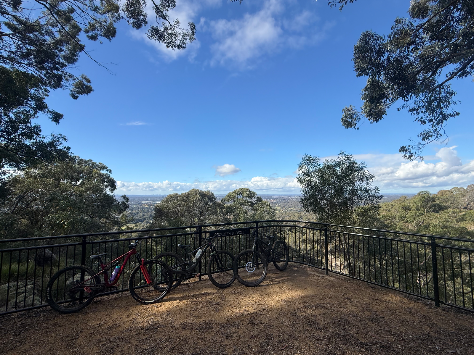
Dungog MTB Park, set within the 650-acre Dungog Common on the western edge of Dungog, has become one of the Hunter region’s standout mountain biking destinations. The Common offers over 30km of singletrack, with trails ranging from easy beginner riding through to difficult technical terrain, plus two purpose-built flow tracks and a fun track. The network rolls through open countryside and forested hills, combining cross-country singletrack, climbs, fast descents and plenty of opportunities to build skills. The trails are managed and maintained by the volunteer-run Ride Dungog, making this a genuine community-built riding destination within easy reach of Newcastle and the Central Coast. RTS Tip: Give yourself plenty of time here — between the XC network, flow tracks and pump/fun track, it’s easy to spend a full day riding. Check the current trail status with Ride Dungog before heading out, particularly after rain. Shuttle services also operate on many weekends and selected holiday periods if you’d rather save your legs and maximise your descending laps.
30 km420 mMTB

Knapsack MTB Trails – Glenbrook Knapsack Reserve is one of the Lower Blue Mountains’ key sanctioned mountain bike areas, sitting at Glenbrook/Lapstone on the eastern escarpment. The reserve combines purpose-built MTB singletrack and a dedicated downhill trail (Stringline Knapsack DH) with historic fire trails and old railway infrastructure, all within easy reach of Western Sydney. Ride Blue Mountains describes Knapsack as having the longest sanctioned MTB trail and the only sanctioned downhill trail in the Blue Mountains. The riding has a distinctly old-school Blue Mountains character. Expect sandstone, rocks, roots, tight natural singletrack, technical sections and plenty of elevation change as trails work their way down the escarpment. The downhill trail provides the more gravity-focused option, while the surrounding trails allow riders to put together shorter XC and trail-style sessions. One of the great things about Knapsack is the setting. The reserve contains remnants of the historic Lapstone Zig Zag railway, including cuttings and the spectacular sandstone Knapsack Viaduct, built in 1867 as part of the original railway crossing of the Blue Mountains. This gives the area a mix of MTB, bushland and railway history that’s pretty unique. Knapsack is also brilliantly positioned for a bigger day on the bike. Nearby Glenbrook provides access to the famous Woodford–Oaks Trail, including its purpose-built technical singletrack section, while Bennetts Ridge and other authorised riding in the Glenbrook area provide plenty of opportunities to extend the adventure. The main reserve access is from Barnet Street, Glenbrook, and the location is relatively easy to reach from Glenbrook and Lapstone stations. For riders searching for Knapsack MTB, Glenbrook mountain bike trails, Blue Mountains MTB, downhill mountain biking near Sydney or mountain biking in the Lower Blue Mountains, Knapsack is an important local network to have on the ride list. RTS Tip: Knapsack is one where current mapping is worth having with you. Ride Blue Mountains notes that signage can be poor and the return route from the downhill trail isn’t particularly obvious until you know the network. There are also many unsanctioned trails elsewhere in the Blue Mountains, so stick to the recognised Knapsack trails rather than assuming every piece of visible singletrack is legitimate.

Verified by 4 ridersRecommended by 2 riders
12 km260 mMTB, XC

Tathra MTB Park’s Bundadung Trail Network is the heart of mountain biking in Tathra on the NSW Sapphire Coast, delivering classic hand-built cross-country singletrack through coastal eucalypt forest just minutes from the beach. Tathra has established itself as one of NSW’s premier MTB towns, with the wider network offering around 50–55km of singletrack and more than 40 trails. Bundadung is the main northern trail network and the birthplace of Tathra’s XC riding scene. Expect plenty of climbing followed by rewarding descents, with tight hand-built singletrack, rocks, log rollovers, gully crossings and natural technical features rather than heavily manicured bike-park terrain. The elevated sections also deliver glimpses out towards the coast and Tathra Beach. The broader Tathra network caters for children and beginners through to experienced riders, so there’s plenty of opportunity to build confidence before tackling the more demanding sections. Bundadung can also be linked with Tathra’s other riding areas, including the Fire Shed trails, creating much longer XC adventures. One of Tathra’s biggest strengths is just how easy it is to ride from town. The main trailhead is near Tathra Beach Country Club, roughly 1km north of the township, while the Mogareeka Cycle and Walkway provides another connection into the MTB network via Katung Road. The trails are very much a community-built network, and that hand-built character is part of the appeal. Rather than huge jumps and gravity lines, Tathra is about linking kilometres of natural singletrack together, exploring the forest and enjoying a proper old-school XC ride in a spectacular coastal setting. There’s also a Mountain Bike Skills Park at Tathra Country Club, giving kids and developing riders somewhere to practise skills in a controlled environment before heading deeper into Bundadung. For riders searching for Tathra MTB, Bundadung MTB Trails, Sapphire Coast mountain biking, South Coast NSW MTB or cross-country mountain biking near Bega, this is one of the region’s must-ride networks. RTS Tip: Tathra is a great contrast to the newer gravity-focused destinations farther down the Sapphire Coast. Think hand-built XC, natural features and lots of linking singletrack rather than a modern shuttle park. With Gravity Eden to the south and Narooma to the north, Tathra also fits brilliantly into a multi-day South Coast MTB road trip.

50 km780 mMTB