Rides

Find your next ride.

Every state, every discipline — the rides Australia is talking about.

Murray
Find a Club

21 ridesof 713

Murray

Showing rides matching “Murray” across Australia.
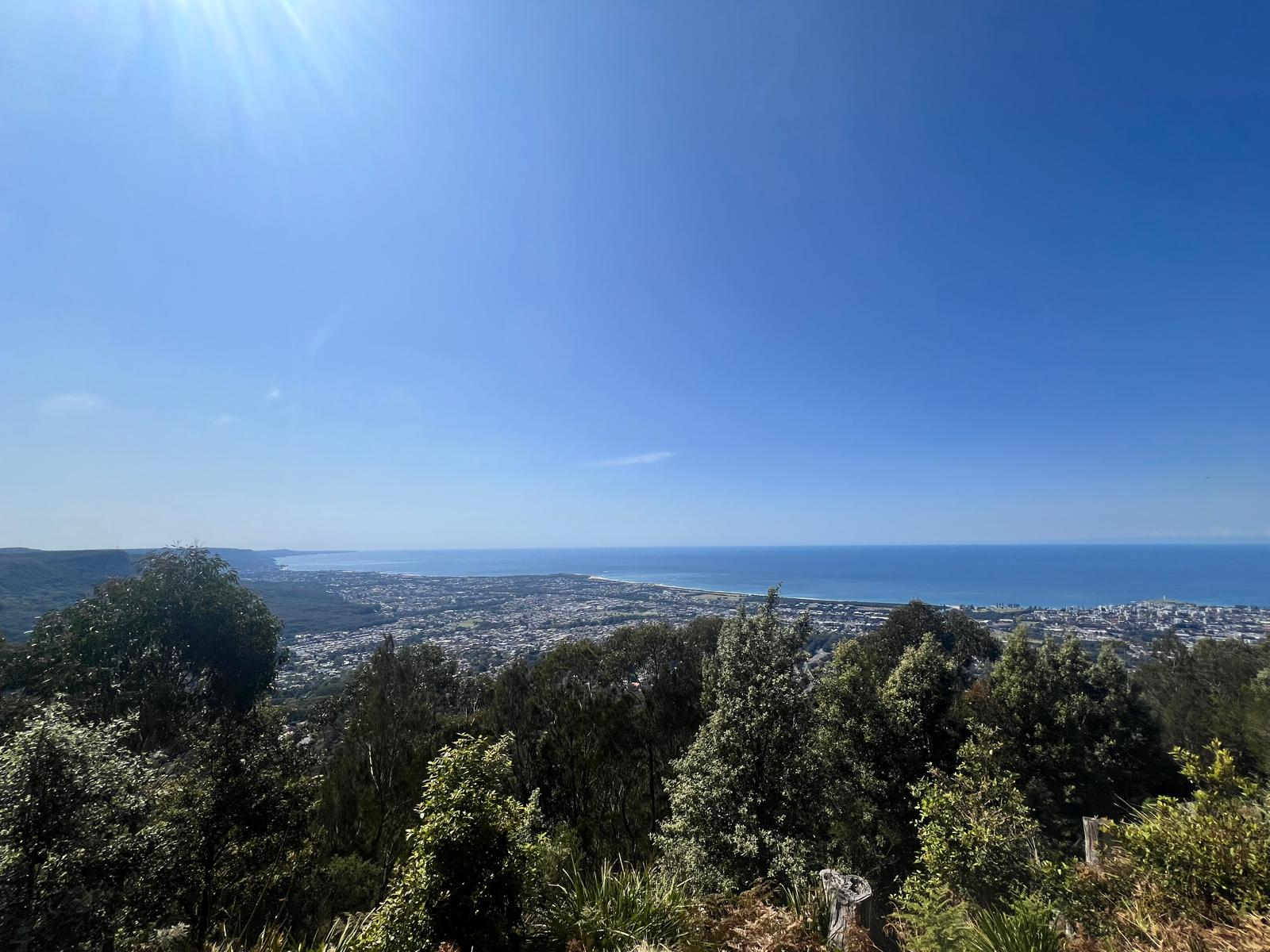
The Murray to Mountains Rail Trail is one of Australia’s premier cycling trails, with around 137 km of sealed trail through North East Victoria and the Victorian High Country. The network connects some of the region’s best-known cycling destinations, including Wangaratta, Myrtleford, Bright, Beechworth, Yackandandah, Oxley, Rutherglen and Wahgunyah, taking riders through the Ovens Valley, farmland, vineyards, historic railway country and the foothills of the Victorian Alps. With a sealed surface and predominantly gentle gradients, it’s suitable for road bikes, gravel bikes, hybrids, e-bikes, families and cycle tourers, although the climb towards Beechworth and the route onwards to Yackandandah are noticeably more demanding. The main Wangaratta to Bright section is around 82–83 km, following the former railway through Bowser, Everton, Gapsted, Myrtleford, Ovens, Eurobin and Porepunkah before reaching Bright. This is classic High Country riding, with farmland and vineyards gradually giving way to increasingly impressive mountain scenery as you approach Bright. With cafés, accommodation, wineries, breweries and food stops scattered throughout the corridor, the route works brilliantly as either a long one-day ride or a relaxed multi-day cycling trip. At Everton, riders can branch towards historic Beechworth and Yackandandah. This section includes the trail’s most significant climbing on the way to Beechworth before continuing through bushland, historic railway cuttings and rolling farmland towards Yackandandah. The Beechworth–Yackandandah extension opened in 2024, adding another major cycling connection between two of North East Victoria’s historic gold-rush towns. There are also separate sections further north. Wangaratta to Oxley is around 9 km, providing an easy connection towards the Milawa Gourmet Region, while the Rutherglen to Wahgunyah section is around 8.5 km, taking riders through renowned wine country towards the Murray River. These shorter sections are excellent choices for families or riders wanting a relaxed half-day experience rather than tackling the longer High Country routes. RTS Tip: You definitely don’t need to ride all 137 km to enjoy the Murray to Mountains Rail Trail. Choose a section that suits your day — Wangaratta to Oxley for an easy food-focused ride, Myrtleford to Bright for spectacular mountain scenery, or Beechworth towards Yackandandah for history and a little more climbing. If you’re planning a multi-day trip, the towns along the route make it easy to build a ride around accommodation, cafés and local produce. Just remember that the network has gaps between some branches, so check the current map carefully before assuming every section connects entirely off-road.

134 kmGravel

Murray Valley MTB Trails The Murray Valley Mountain Bike Trails, near Dwellingup in Western Australia, are one of the standout riding areas within Lane Poole Reserve and the wider Dwellingup Adventure Trails network. Set high above the Murray River amongst towering jarrah forest, the purpose-built singletrack network caters for beginner, intermediate and advanced mountain bikers, with 5 green, 8 blue and 3 black trails. Expect a combination of flowing berms, rollers, jumps, rocky technical features, climbing trails and fast gravity-fed descents, all surrounded by classic South West WA forest. The network is designed around a central upper trailhead known as The Roost, where riders are rewarded with impressive views across the Murray Valley before choosing their descent. Easier trails such as Year 1 provide a flowing introduction to the network, while the blue trails introduce narrower singletrack, loose and rocky surfaces, steeper sections and more technical features. Experienced riders can step up to the black trails, where steeper gradients and larger technical obstacles make the riding considerably more demanding. One of Murray Valley’s biggest attractions is its gravity riding. Riders can pedal back to the top using the dedicated easy and intermediate climbing trails or use the shuttle road off Murray Valley Road, making it possible to build a day around repeated descending laps. The trails form part of the much larger Dwellingup Adventure Trails network, with nearby riding at Marrinup and Turner Hill plus the long-distance Munda Biddi Trail, making Dwellingup an excellent base for a full mountain biking weekend. RTS Tip: If it’s your first time at Murray Valley, climb to The Roost and start with one of the green descents before progressively working through the blues and blacks — there’s plenty here for riders to build confidence without jumping straight into the harder gravity terrain. Lane Poole Reserve entry fees apply, and mobile coverage can be limited away from the upper trailhead, so download the current trail map before riding. Carry water, repair gear and check trail and park conditions before travelling, particularly after heavy rain or during high fire danger.

35 kmMTB

Murray Valley Regional Park MTB Trails – Moama & Deniliquin Murray Valley Regional Park stretches along the Murray and Edward rivers in southern NSW, with huge river red gum forests, wetlands and riverside landscapes providing the backdrop for some excellent purpose-built mountain biking. The park is spread across numerous areas rather than being one single riding destination, with dedicated MTB networks near Moama and Deniliquin. One of the highlights is the Five Mile mountain bike trail near Moama. This purpose-built network offers around 7km of trails suitable for a range of abilities, with fast rolling terrain complemented by berms, jumps, rollers, drops, wall rides and flowing bridges. There’s also a pump track and dedicated skills area, making Five Mile a particularly good option for families and riders looking to build confidence. Further north, the Deniliquin mountain bike trails provide another 12km of purpose-built singletrack close to town. Three loop trails wind through beautiful river red gum forest near the Edward River, with the network officially graded medium and aimed primarily at intermediate riders. The wider Murray Valley Regional Park - Deniliquin is also fantastic country to explore by bike, with forest roads, riverside areas and connections around the park providing opportunities to extend the adventure beyond the dedicated singletrack. The Regional Park itself extends through multiple precincts along the Murray and Edward river systems, so it’s worth planning which section you want to explore before setting out. For riders searching for Murray Valley mountain bike trails, Moama MTB, Deniliquin MTB, mountain biking near Echuca or MTB trails along the Murray River, this is a great region to have on the ride list. RTS Tip: Don’t think of Murray Valley Regional Park as one continuous MTB network. For dedicated singletrack, target Five Mile at Moama or the Deniliquin MTB Trails and use the individual trail maps to plan your ride. Five Mile is the more family/progression-focused option, while Deniliquin is better suited to intermediate riders. Also check current NSW National Parks alerts before travelling, as flooding, fire conditions and other events can affect access in these river environments.

MTB

Culcairn–Corowa Rail Trail – Riverina NSW, is an exciting developing cycling project in southern NSW, with a long-term vision to create a 76km cycling and walking trail between Culcairn and Corowa on the Murray River. Following the route of the former Culcairn–Corowa railway line, the proposed trail would travel through classic Riverina farming country and connect the communities of Culcairn, Walla Walla, Burrumbuttock, Brocklesby, Balldale, Hopefield and Corowa. The railway originally opened in 1892 and played an important role transporting wheat and other freight through the region. For now, the rail trail is only partially open. Approximately 2km of sealed trail is available at the Corowa end, running from the former Corowa Station precinct to Bullecourt Road. The rest of the 76km railway corridor has not yet been developed as a public cycling trail, and much of it passes through private property. Despite its short current length, the Corowa section can be incorporated into a much bigger cycling day. Corowa sits directly across the Murray River from Wahgunyah, where riders can connect with the Murray to Mountains Rail Trail towards Rutherglen, opening up some fantastic cycling through the wineries and countryside of north-east Victoria. The future vision is particularly exciting. If the full Culcairn–Corowa corridor is developed, there is also potential for another 26km extension from Culcairn to Holbrook, creating more than 100km of connected rail trail and a significant new cycling destination in southern NSW. A local committee is actively progressing the Culcairn–Corowa proposal, with support identified in Greater Hume Council's strategic planning. For riders searching for Corowa cycling, Culcairn bike trails, Riverina rail trails, cycling around the Murray River or rail trails in southern NSW, the existing Corowa section provides a small taste of what could eventually become a brilliant regional cycling route. RTS Tip: The full Culcairn to Corowa Rail Trail is NOT currently open. Only around 2km at the Corowa end is developed for public use, and trespassing on the undeveloped railway corridor is prohibited. For a longer ride today, combine the open Corowa section with local cycling connections across the Murray towards Wahgunyah and Rutherglen. RTS will keep an eye on this one and update the Ride Card as additional sections are officially developed and opened.

2 kmGravel

Kinchina Conservation Park, just west of Murray Bridge in South Australia’s Murraylands, offers an extensive network of mountain bike and shared-use trails through 414 hectares of native woodland, rocky gullies and distinctive granite outcrops. Around 70 km from Adelaide, the park is a great option for riders looking for accessible Murray Bridge mountain biking, with designated tracks that can be combined into a variety of loops. Key MTB routes include the 4.2 km Jailbreak Trail, 1.9 km Getaway Car Loop, 1.8 km Jailhouse Rocks Loop, 1.7 km Cemetery Trail and the more challenging 600 m Rocky Gully Link Trail. The wider network also connects with the Lavender Federation Trail, giving riders plenty of scope to extend their adventure. Another highlight is the 6.3 km Cypress Hill Trail, a multi-use green-grade mountain bike trail that winds through Callitris woodland on the northern side of Rocky Gully. Kinchina’s mixture of flowing tracks, rocky terrain, creek lines and natural bushland makes it suitable for everything from a shorter recreational ride to a longer cross-country MTB loop. Spring is an especially rewarding time to visit, when orchids, lilies and native wildflowers add even more colour to the landscape. RTS Tip: Kinchina is ideal for creating your own loop by linking several of the designated trails together. Most of the MTB routes are rated intermediate, while Rocky Gully Link is advanced, so check the park map and trail grading before setting out. Bikes must remain on formed designated tracks, and riders are asked to avoid the trails when they’re wet or muddy. The park can also close during Catastrophic Fire Danger and potentially on Extreme Fire Danger days, so check current park conditions during warmer weather.

414 kmGravel

Moama MTB Park, also known as the Five Mile Mountain Bike Trail, offers around 7 km of purpose-built mountain bike trails near Moama and Echuca on the NSW–Victoria border. Located within Murray Valley Regional Park beside the Murray River, the trails wind beneath towering river red gums and are designed to cater for a broad range of abilities, making Five Mile a great option for beginners, families and experienced riders looking for a fun cross-country session. The network combines fast, rolling singletrack with berms, rollers, jumps, drops, wall rides and flowing bridge features, packing plenty of variety into its relatively short distance. There’s also a dedicated skills area and pump track, giving newer riders somewhere to practise bike handling while more experienced riders can session features before heading back onto the main trail. The relatively flat Riverina landscape means the riding is more about carrying speed, cornering and enjoying the flow than tackling long climbs. Set around 8 km from Moama along Perricoota Road, Five Mile mountain bike trail is easy to combine with a wider Echuca–Moama cycling trip. After riding, the nearby Five Mile picnic area provides a scenic spot beside the Murray River to relax, picnic or make a longer day of the visit. Parking is available at the MTB trail, although NSW National Parks notes that it can become busy on weekends. RTS Tip: Five Mile is a brilliant spot for riders wanting to build MTB skills without huge climbs. Use the pump track and skills area first, then take those skills onto the rollers, berms and features of the main trail. Summer temperatures in the Murray region can be extreme, so ride early, carry plenty of water and check current Murray Valley Regional Park alerts before travelling. Mobile reception can also be limited within the park, so download any information you need before setting out.

MTB

Coomealla Mountainless MTB Park – Dareton Coomealla-Mildura Mountainless Bike Club Park is a purpose-built cross-country mountain bike park at Dareton in south-west NSW, tucked beside the Murray River behind Coomealla Golf Club and just across the border from Mildura. Despite the name, you don't need mountains to create great mountain biking. The park makes clever use of the relatively flat Murray River landscape, with twisting singletrack, gullies, short climbs and descents, berms, jumps and natural features packed into the terrain. There are around 21 mapped MTB trails covering approximately 16km, with most riding sitting in the green and blue grades. That makes Coomealla particularly good for beginners, families and younger riders, while optional features and more challenging sections provide enough variety to keep experienced riders entertained. Two main marked routes make exploring easy. The shorter Coomie 5km Loop links together some of the park's highlights, while the Coomie Long Track runs for approximately 11km and takes in much of the network. There are also numerous linking tracks, so riders can mix things up and build their own session. The park is closely connected with the Coomealla Mildura Mountainless Bike Club, which welcomes riders from juniors through to experienced racers and runs social rides and racing. Its location makes the network a great option for anyone searching for mountain biking in Mildura, MTB trails around Dareton, Murray River mountain biking or places to ride in the Sunraysia region. RTS Tip: The Trail Head - Coomealla Mountainless Bike Park is approximately 1km beyond the Coomealla Golf Club clubhouse, accessed via an unsealed track alongside the Murray River. Use current trail mapping to explore the network and check local conditions before heading out, particularly following wet weather or periods of Murray River flooding.

MTB

The Dargo High Plains is one of Australia's premier bikepacking adventures, taking riders deep into the spectacular Victorian High Country across 304km of alpine roads, rugged gravel tracks and remote wilderness. This is a ride for experienced cyclists looking to immerse themselves in breathtaking mountain scenery, challenging terrain and unforgettable backcountry riding. Beginning in Wangaratta, the route follows the popular Murray to Mountains Rail Trail through the gourmet towns of Milawa, Beechworth, Bright and Porepunkah, where cafés, breweries, wineries and local produce provide plenty of reasons to slow down before the real adventure begins. Beyond Porepunkah, the route heads into the remote Buckland Valley before climbing onto the spectacular alpine tracks of the High Country. Expect steep climbs, rough gravel roads, rocky sections and incredible mountain vistas as you traverse one of Victoria's most iconic alpine landscapes. Riders are rewarded with an unforgettable journey across the Dargo High Plains, followed by a thrilling descent into the historic township of Dargo. From Dargo, the ride continues through forests and rolling farmland to Bairnsdale, completing an epic point-to-point adventure that showcases everything from alpine wilderness and quiet gravel roads to charming country towns and world-class scenery. Depending on your bike choice and riding style, a gravel bike with wide tyres is suitable, although many riders will appreciate the comfort and capability of a cross-country mountain bike on the rougher sections. This is a true backcountry ride, with long stretches between services, limited water sources and rapidly changing alpine weather. Careful planning, sufficient supplies and experience in remote riding are essential. For riders seeking one of Australia's great multi-day cycling adventures, the Dargo High Plains is an unforgettable journey through the heart of Victoria's High Country.

303.6 km5296 mGravel

Dwellingup Trails is one of Western Australia’s premier mountain biking destinations, with a huge and growing network of purpose-built trails running directly from town into the surrounding jarrah forest. The town-side Dwellingup MTB network now connects through Marrinup to Turner Hill, creating around 68km of dedicated singletrack, with green and blue cross-country trails, flowing descents and technical features for progressing riders. Just south of town, Murray Valley adds more than 50km of purpose-built riding inside Lane Poole Reserve, ranging from beginner-friendly flow through to serious black descents packed with jumps, rock gardens and drops. Add Tom’s Crossing, the historic Marrinup Circuit and the long-distance Munda Biddi Trail and Dwellingup easily earns its reputation as a place worth spending several days on the bike. RTS Tip: Start at the Dwellingup Trails and Visitor Centre for current trail conditions, maps and local advice before choosing your ride. If you’re new to the area, explore the town and Marrinup trails first, then head into Lane Poole Reserve for the Murray Valley network when you’re ready for bigger descents. Entry fees apply to Lane Poole Reserve, and there’s no drinking water at the Murray Valley trailhead, so fill up before leaving town.

17 kmMTB

The Echuca–Moama Velodrome is an outdoor cycling track in Moama, NSW, and home to the Echuca Moama Cycling Club, supporting track cycling, racing and rider development across the twin towns and wider Murray region. Located within Moama Recreation Reserve, the velodrome sits alongside a purpose-built criterium track, creating a dedicated cycling precinct where riders can train, race and develop their skills away from regular road traffic. The current velodrome was constructed in 1991–92, continuing a much longer history of cycling in Echuca–Moama. Organised cycling in the area can be traced back to 1869, while the famous Echuca Boxing Day Cycling Carnival began in 1906. The first Boxing Day Carnival at the new Moama velodrome was held in 1992. Today, Echuca Moama Cycling Club continues that tradition with track cycling, criterium and road racing, junior development and social riding. The club places a strong emphasis on welcoming riders of different ages and abilities and encouraging the next generation into cycling. For riders searching for Echuca Velodrome, Moama Velodrome, track cycling in Echuca–Moama, Echuca Moama Cycling Club or cycling facilities on the Murray River, the velodrome is an important part of the region's cycling scene. RTS Tip: The velodrome and neighbouring criterium circuit are active club training and racing facilities, so check current Echuca Moama Cycling Club activities before making a special trip. If you're interested in trying track cycling, getting in touch with the club is a great place to start.

0.295 km99 mTrack

The Eudunda Hampden Rail Trail is a newly completed 5km shared trail following the former railway corridor from Eudunda to the tiny settlement of Hampden in South Australia’s Mid North. Officially opened in April 2026, the trail has a smooth fine-gravel surface and follows a steady, gentle climb out of Eudunda through historic railway cuttings, pine-lined embankments and open farmland. Along the way you’ll pass the former Eudunda Railway Station, silo art, old railway infrastructure and Centenary Gardens, before reaching Hampden. The easy gradients make it a great option for families and newer riders, while its connection to the 300km Lavender Cycling Trail between Murray Bridge and Clare gives longer-distance riders plenty of scope to keep exploring. RTS Tip: Ride Eudunda to Hampden first and enjoy the easy downhill roll on the way back. Eudunda is the best place to start, with parking, toilets, picnic facilities, cafés, a bakery and supermarket nearby, while there are no facilities at Hampden. If 10km return isn’t enough, continue from Hampden onto the Lavender Cycling Trail or one of the local gravel loops for a much bigger day out.

5 kmGravel

Flame Trees is a fun cross-country MTB loop just outside Beechworth in Victoria’s High Country, running alongside the Murray to Mountains Rail Trail. Built for riders stepping into mountain biking but still entertaining when ridden at speed, the approximately 10km clockwise loop mixes flowing singletrack with rocky sections, frequent gradient changes, short technical descents into shaded gullies and snaking switchback climbs back towards the rail trail. The trail is managed by the volunteer Beechworth Chain Gang and makes a great alternative to the more technical Beechworth MTB Park, particularly for families and newer riders wanting to build their confidence. RTS Tip: Leave the car in Beechworth and make the ride a little bigger — it’s around a 5km cruise along the Murray to Mountains Rail Trail to reach Flame Trees near the old Baarmutha railway station site. Alternatively, there’s a small car park where Diffey Road crosses the rail trail. There are no toilets or drinking water at the Flame Trees trailhead, so fill your bottles and come prepared before heading out.

MTB

Stretching through Victoria’s spectacular north-east, the High Country Rail Trail follows the former railway corridor from Wodonga toward the Upper Murray, taking riders through open farmland, historic towns and some seriously impressive High Country scenery. One of the highlights is the long waterside section beside Lake Hume, with views across the water to the surrounding hills, while restored railway infrastructure and old station sites add plenty of character along the way. With a predominantly gravel and compacted surface and multiple access points, it works equally well for a relaxed day ride, family adventure or longer point-to-point journey. Riders can choose a section that suits them or link together a much bigger High Country adventure. RTS Tip: Don’t feel like you need to tackle the whole trail at once. Pick a section around Lake Hume for a scenic shorter ride, or use the trail as the backbone of a multi-day High Country trip. Conditions can be exposed, particularly in summer, so carry plenty of water and check your chosen section and access points before setting off.

80 kmGravel

Mystic Bike Park in Bright, Victoria, is one of Australia’s premier mountain biking destinations, sitting just minutes from the centre of town in the heart of the Victorian High Country. The park offers 60+ km of purpose-built MTB trails and more than 20 individual trails, with around 450–500 metres of vertical elevation across the mountain. Riders can choose from beginner-friendly singletrack through to technical cross-country, fast flow trails, jump lines and expert downhill terrain, all winding through the distinctive pine plantation overlooking Bright and the surrounding alpine ranges. Mystic is particularly well known for its gravity riding, with favourites including Hot Wheels, Flowmingo, Flight School, Couch Surfer, Wiggles and Tombstone. The network is designed with progression in mind, so developing riders can build confidence on easier flow trails before moving onto bigger jumps, steeper terrain and advanced technical descents. There’s also a pump track and BMX track at the base, while technical XC trails provide plenty for riders who would rather earn their descents. Mystic operates as a professionally managed, paid-access bike park, with both pedal access and uplift options. Pedal access is available daily and the park operates year-round, while shuttle uplifts run on weekends and holidays, providing access to the higher gravity trails. Bike hire, e-bike hire, coaching and guided riding are also available, with water, toilets, tools and a bike wash located at the main Coronation Avenue trailhead. Its location makes Mystic an ideal base for a bigger Bright mountain biking holiday. Riders can combine park laps with nearby High Country gravel routes, the Murray to Mountains Rail Trail, Great Valley Trail and other MTB destinations around Mount Beauty, Falls Creek and Dinner Plain. RTS Tip: Mystic is a big network with a serious progression from beginner trails through to double-black downhill, so use your first few laps to get familiar with the terrain rather than jumping straight onto the hardest lines. A Mountain Pass is required even if you’re pedalling, with shuttle access purchased separately. Check the current trail status before travelling, inspect unfamiliar jumps and technical features before committing, and if you’re planning a gravity day, booking your shuttle ahead is worthwhile during weekends and busy holiday periods.

MTB

The Renmark – Paringa Rail Trail is an easy 4 km sealed cycling and walking trail in South Australia’s Riverland, connecting the Murray River towns of Renmark and Paringa. Around 260 km north-east of Adelaide, the trail follows the former railway reserve and provides a largely off-road alternative to riding along the busy Sturt Highway. With a smooth hot-mix surface, gentle gradients and plenty to see along the way, it’s particularly well suited to families, beginner cyclists, e-bikes, hybrids, touring bikes and recreational riders. Starting near Darnley Taylor Park and Renmark Plaza, the trail follows the former railway corridor east towards the Murray River. Riders pass the site of the old Renmark railway station and freight yards, where an original railway crane remains, before crossing several historic railway bridges over the wetlands and waterways between Renmark and Paringa. There are also direct connections from the rail trail into the Renmark Riverfront Trail and Paringa Paddock MTB Trails, making it easy to turn the short rail trail into a longer Riverland cycling adventure. The highlight is crossing the historic Paringa Bridge over the Murray River. Built in 1927, the bridge originally carried both road vehicles and trains, with the railway running through its central corridor. That former railway section is now used as the cycle path, while road traffic travels on separate decks alongside it. The bridge still has its original lifting span, which operates daily to allow larger river vessels to pass. After crossing into Paringa, riders can detour to Bert Dix Memorial Park and Lock 5. The 6.7 km Lock 5 Loop Trail incorporates part of the former railway route before following the Murray River towards Lock 5, providing an excellent extension for riders wanting more distance. Alternatively, head into Paringa Paddock, where two main loops and several alternative trails provide easy, flat mountain biking through the Murray River floodplain. The railway itself was part of the historic Barmera line. Rail reached Paringa in 1913, but construction of the Murray River bridge was delayed by World War I, meaning trains did not reach Renmark until 1927. The line was extended to Barmera the following year before eventually closing west of Paringa in 1984, with the tracks removed by 1986. RTS Tip: At only 4 km one way, this is a great trail to combine with Renmark’s other cycling routes. Ride from Renmark across the Paringa Bridge, add the Lock 5 Loop or Paringa Paddock MTB trails, then return via the riverfront for a much bigger ride. Take particular care at the Sturt Highway crossings at either end of Paringa Bridge. The bridge lifting span currently operates daily at 9:30 am and 2:30 pm, so time your ride carefully — or stop at Bert Dix Memorial Park and watch the bridge lift.

4 kmGravel

The Rosstown Rail Trail follows the historic route of the former Rosstown Railway through Melbourne’s south-eastern suburbs, linking Elsternwick with the Oakleigh/Hughesdale area. The heritage route is around 8.5km long, while Glen Eira City Council identifies approximately 7.4km as the improved cycling trail between Elsternwick and Hughesdale. Rather than being one continuous off-road path, the route uses a combination of linear parks, shared paths and quiet local streets. The terrain is generally flat and suitable for riders of most abilities, making it a relaxed way to explore this part of Melbourne while following the footprint of a railway that never really fulfilled its intended purpose. The trail passes through suburbs including Elsternwick, Caulfield South, Carnegie and Murrumbeena, with sections travelling through attractive green corridors such as Marara Road Reserve. Recent improvements have included additional signage, bicycle markings, raised crossings and traffic-calming measures to make the route easier and safer to follow. The history behind the trail is particularly interesting. The private Rosstown Railway was the ambitious project of entrepreneur William Murray Ross, who planned to use it to transport sugar beet to his mill and refined sugar towards the Port of Melbourne. The project struggled with funding and construction delays, the mill never went into production, and the railway eventually fell into disrepair without becoming a successful operating line. RTS Tip: Rosstown is more of an urban heritage ride and cycling connector than a traditional continuous rail trail. There are on-road sections and intersections along the way, so keep an eye on the route signage. With Elsternwick Station near one end and the Djerring Trail and wider Melbourne cycling network accessible around the eastern end, it’s also easy to incorporate Rosstown into a much longer urban ride.

9 kmGravel

Tom’s Crossing MTB Trails Tom’s Crossing, within Lane Poole Reserve near Dwellingup, Western Australia, is a compact, gravity-focused MTB network built for riders who enjoy steep, technical downhill terrain. The network consists of four purpose-built descending trails totalling around 5 km, with blue and black-rated riding plus optional black and double-black features. Unlike the more accessible trails elsewhere around Dwellingup, Tom’s Crossing is aimed primarily at confident intermediate through advanced riders. The two blue trails are The Luge (1.5 km) and Slingshot (1.1 km). The Luge is the best introduction, with short steep descents, extended off-camber sections and fast corners. Slingshot turns up the technical challenge with rock slabs, drops, step-ups and step-downs, plus optional black-rated features for riders looking to progress. Advanced riders can tackle Devils Pass (1 km) and Mayhem (1.4 km). Devils Pass is packed with rock gardens, slabs, chutes and drops, including its distinctive road-crossing feature, while Mayhem is a fast and steep black descent with large unavoidable technical features. Both offer optional double-black lines for highly skilled riders. The network was rebuilt in 2024, creating the current four-trail layout while integrating Tom’s Crossing into the broader Dwellingup Adventure Trails network. Riders can also connect towards the Murray Valley MTB Trails for a much broader mix of green, blue and black riding through the surrounding jarrah forest. Access is through Lane Poole Reserve, following Park Road to the shuttle access road. Nearby facilities are available at Dwaarlindjirraap, while the Dwellingup Trails and Visitor Centre in town provides maps, toilets, showers, lockers and other rider facilities. Mobile coverage can be limited within the reserve. RTS Tip: Make The Luge your first run, even if you're an experienced rider, to get a feel for Tom’s Crossing’s steep terrain and conditions. A sighting lap is strongly recommended before committing to the harder A-lines or double-black features. Full-face helmets and appropriate protective equipment are recommended for this gravity-focused network. If the blue trails already feel challenging, head across to Murray Valley rather than progressing to Devils Pass or Mayhem — the black trails contain serious, committing features.

MTB

Turner Hill MTB Trails, between North Dandalup and Dwellingup in Western Australia, is a classic cross-country mountain bike destination known for its fast, flowing singletrack, rocky technical features and punchy climbs and descents. The main trail is an approximately 11 km blue-rated loop, designed for intermediate riders with some technical MTB experience. It winds through the jarrah forest on almost continuous singletrack, with tight corners, rocks, obstacles and optional lines keeping the riding interesting from start to finish. Turner Hill Mountain Bike Track has a traditional hand-built XC feel rather than the smoother character of a modern flow park. Recent upgrades retained that character while adding around 2.5 km of optional lines and alternative descents, giving experienced riders extra features to explore without fundamentally changing the original loop. If you don't want to tackle the full circuit, a shortcut reduces the main ride to around 5.4 km while retaining much of the fun terrain. There's also Tiny Turner, a 1.1 km green-rated beginner loop starting from the car park, with easy rock features and playful tight turns. This gives younger and developing riders somewhere to build confidence before progressing onto the blue loop. Turner Hill is now part of the much larger Dwellingup Adventure Trails network. Recent development has created around 16 km of new MTB trail linking Marrinup with Turner Hill, opening up the possibility of much longer rides rather than simply completing laps of the original circuit. The wider Dwellingup area also includes the Murray Valley network and gravity-focused Tom's Crossing trails. The trailhead is accessed from Scarp Road, with the final approach along graded unsealed road. Parking and a public toilet are available, but there is no drinking water, so arrive self-sufficient. Trails WA recommends April to October as the best riding period. RTS Tip: For your first visit, ride the 11 km Turner Hill loop clockwise as intended and take the optional lines only once you've got a feel for the terrain. Newer riders can start on Tiny Turner, while stronger XC riders can now link Turner Hill with Marrinup for a considerably bigger forest adventure. Bring plenty of water and download your map before leaving Dwellingup — mobile coverage at Turner Hill is limited, with Trails WA currently reporting Telstra coverage but little or none from other networks.

11 kmMTB

The Waranga Rail Trail is a 19km shared-use trail connecting the historic towns of Rushworth and Murchison in northern Victoria. Following the route of the former railway line, the mostly flat trail travels through bushland, farmland and former gold-mining country, skirting the impressive Waranga Basin and passing the wetlands of Doctors Swamp Wildlife Reserve. The route combines fine gravel with a short asphalt section near Rushworth and crosses several restored railway bridges, including the historic bridge over the Stuart Murray Canal. With relatively gentle terrain and plenty to see along the way, it’s a great option for gravel bikes, hybrids and mountain bikes, with Rushworth or Murchison making an easy turnaround point for a 38km return ride. RTS Tip: Make time to explore the towns at either end — both Rushworth and Murchison have cafés, bakeries, picnic areas and facilities, making this an easy ride to turn into a relaxed day out. There are two crossings of the busy Murchison–Rushworth Road along the trail, so take care when crossing.

19 kmGravel

The Waranga Rail Trail is a 19 km shared cycling and walking trail connecting Murchison and Rushworth in northern Victoria. Fully completed in 2025, it follows the former railway corridor through Box-Ironbark country, farmland, wetlands and the Waranga Basin landscape. With an almost level gradient and a combination of fine gravel and asphalt, it’s an excellent option for families, gravel bikes, mountain bikes, hybrids and recreational riders. The trail begins at Impey Street in Murchison and heads west towards Rushworth. Along the way it passes Doctors Swamp Wildlife Reserve, an important wetland habitat, and crosses numerous irrigation channels associated with the enormous Waranga Basin. One of the highlights is the restored historic bridge across the Stuart Murray Canal, along with several other former railway bridges incorporated into the route. Most of the trail has a fine-gravel surface, while the final kilometre approaching Rushworth is smooth asphalt through the former railway yard. The route is generally easy, although riders need to take care at two crossings of the Murchison–Rushworth Road. Both Murchison and Rushworth have toilets, picnic facilities and plenty of options for a post-ride bakery or café stop. The railway originally opened between Murchison East and Rushworth in 1890, later extending to Colbinabbin, with Rushworth becoming a junction when the branch towards Girgarre opened in 1917. Part of the railway had to be diverted when Waranga Basin was constructed in 1905, and the various lines eventually closed by 1987. The first 8 km between Murchison and Channel Inlet Road opened in 2015, before the remaining 11 km to Rushworth was completed a decade later. The finished Waranga Rail Trail opened to riders on 1 April 2025 and was officially opened on 17 May 2025, finally creating the continuous 19 km route. There are also exciting possibilities for future connections. Plans have been discussed to extend the Stanhope–Girgarre Rail Trail south towards Rushworth, while a future Murchison–Heathcote connection could eventually link Waranga with the O’Keefe Rail Trail. RTS Tip: The full Murchison–Rushworth return ride is around 38 km, but the flat railway gradient makes it a very achievable longer recreational ride. For something shorter, ride from either town towards Waranga Basin and return. Gravel or wider hybrid tyres are ideal for the mostly fine-gravel surface. If you're arriving by train at Murchison East, be aware that the connection into Murchison isn't entirely traffic-free and includes a busy road crossing and the Goulburn River bridge, where riders need to dismount.

19 kmGravel

Wyong & Laguna Gravel Loop – Central Coast NSW The Wyong & Laguna Gravel Loop is an epic full-day gravel adventure linking the NSW Central Coast with the forests and valleys of the Watagans and Hunter Valley. Starting from Wyong, the route leaves the traffic behind and heads towards Watagan Forest Road, where the gravel begins almost immediately with a steady climb into the forest. From here, riders follow beautiful undulating gravel roads through the Watagans, with forested ridgelines, valleys and long stretches beneath the canopy creating some brilliant riding. The route passes Olney Headquarters campground before turning onto Wollombi Forest Road and beginning the descent towards Watagan Creek. The landscape changes dramatically as you drop from the forest into the valley, where flowing gravel follows Watagan Creek through farmland towards Laguna. Laguna provides the perfect halfway destination and an important opportunity to refill water and grab some food before tackling the return journey. From Laguna, the route heads south before turning back onto gravel around Murrays Run Road, following Wollombi Brook through more farmland and quiet country before another substantial climb. One of the rewards comes later with the long Brush Creek Road descent, dropping through beautiful forest on well-graded gravel before the route eventually works its way towards Yarramalong and back to Wyong. It's a big day on the bike, combining long gravel sectors, sustained climbing, forest roads, rural valleys and some fantastic descents. For experienced riders searching for gravel riding near Sydney, Newcastle or the Central Coast, this is one worth putting on the list. Another huge bonus? Wyong Station makes the ride accessible by train, opening up the possibility of a serious gravel adventure without needing to drive to the trailhead. RTS Tip: Water and resupply opportunities are limited through much of the route, so carry plenty with you and make the most of the stop at Laguna. Download your navigation before leaving, carry repair equipment and check current forestry, road, weather and fire conditions before setting out. Conditions in the Watagans can change considerably following rain.

100 kmGravel, Road

Outside your filter

Also trending right now

Dungog MTB Park, set within the 650-acre Dungog Common on the western edge of Dungog, has become one of the Hunter region’s standout mountain biking destinations. The Common offers over 30km of singletrack, with trails ranging from easy beginner riding through to difficult technical terrain, plus two purpose-built flow tracks and a fun track. The network rolls through open countryside and forested hills, combining cross-country singletrack, climbs, fast descents and plenty of opportunities to build skills. The trails are managed and maintained by the volunteer-run Ride Dungog, making this a genuine community-built riding destination within easy reach of Newcastle and the Central Coast. RTS Tip: Give yourself plenty of time here — between the XC network, flow tracks and pump/fun track, it’s easy to spend a full day riding. Check the current trail status with Ride Dungog before heading out, particularly after rain. Shuttle services also operate on many weekends and selected holiday periods if you’d rather save your legs and maximise your descending laps.

30 km420 mMTB

Tathra MTB Park’s Bundadung Trail Network is the heart of mountain biking in Tathra on the NSW Sapphire Coast, delivering classic hand-built cross-country singletrack through coastal eucalypt forest just minutes from the beach. Tathra has established itself as one of NSW’s premier MTB towns, with the wider network offering around 50–55km of singletrack and more than 40 trails. Bundadung is the main northern trail network and the birthplace of Tathra’s XC riding scene. Expect plenty of climbing followed by rewarding descents, with tight hand-built singletrack, rocks, log rollovers, gully crossings and natural technical features rather than heavily manicured bike-park terrain. The elevated sections also deliver glimpses out towards the coast and Tathra Beach. The broader Tathra network caters for children and beginners through to experienced riders, so there’s plenty of opportunity to build confidence before tackling the more demanding sections. Bundadung can also be linked with Tathra’s other riding areas, including the Fire Shed trails, creating much longer XC adventures. One of Tathra’s biggest strengths is just how easy it is to ride from town. The main trailhead is near Tathra Beach Country Club, roughly 1km north of the township, while the Mogareeka Cycle and Walkway provides another connection into the MTB network via Katung Road. The trails are very much a community-built network, and that hand-built character is part of the appeal. Rather than huge jumps and gravity lines, Tathra is about linking kilometres of natural singletrack together, exploring the forest and enjoying a proper old-school XC ride in a spectacular coastal setting. There’s also a Mountain Bike Skills Park at Tathra Country Club, giving kids and developing riders somewhere to practise skills in a controlled environment before heading deeper into Bundadung. For riders searching for Tathra MTB, Bundadung MTB Trails, Sapphire Coast mountain biking, South Coast NSW MTB or cross-country mountain biking near Bega, this is one of the region’s must-ride networks. RTS Tip: Tathra is a great contrast to the newer gravity-focused destinations farther down the Sapphire Coast. Think hand-built XC, natural features and lots of linking singletrack rather than a modern shuttle park. With Gravity Eden to the south and Narooma to the north, Tathra also fits brilliantly into a multi-day South Coast MTB road trip.

50 km780 mMTB

Editor's picks

More rides worth saving

Dungog MTB Park, set within the 650-acre Dungog Common on the western edge of Dungog, has become one of the Hunter region’s standout mountain biking destinations. The Common offers over 30km of singletrack, with trails ranging from easy beginner riding through to difficult technical terrain, plus two purpose-built flow tracks and a fun track. The network rolls through open countryside and forested hills, combining cross-country singletrack, climbs, fast descents and plenty of opportunities to build skills. The trails are managed and maintained by the volunteer-run Ride Dungog, making this a genuine community-built riding destination within easy reach of Newcastle and the Central Coast. RTS Tip: Give yourself plenty of time here — between the XC network, flow tracks and pump/fun track, it’s easy to spend a full day riding. Check the current trail status with Ride Dungog before heading out, particularly after rain. Shuttle services also operate on many weekends and selected holiday periods if you’d rather save your legs and maximise your descending laps.
30 km420 mMTB

Knapsack MTB Trails – Glenbrook Knapsack Reserve is one of the Lower Blue Mountains’ key sanctioned mountain bike areas, sitting at Glenbrook/Lapstone on the eastern escarpment. The reserve combines purpose-built MTB singletrack and a dedicated downhill trail (Stringline Knapsack DH) with historic fire trails and old railway infrastructure, all within easy reach of Western Sydney. Ride Blue Mountains describes Knapsack as having the longest sanctioned MTB trail and the only sanctioned downhill trail in the Blue Mountains. The riding has a distinctly old-school Blue Mountains character. Expect sandstone, rocks, roots, tight natural singletrack, technical sections and plenty of elevation change as trails work their way down the escarpment. The downhill trail provides the more gravity-focused option, while the surrounding trails allow riders to put together shorter XC and trail-style sessions. One of the great things about Knapsack is the setting. The reserve contains remnants of the historic Lapstone Zig Zag railway, including cuttings and the spectacular sandstone Knapsack Viaduct, built in 1867 as part of the original railway crossing of the Blue Mountains. This gives the area a mix of MTB, bushland and railway history that’s pretty unique. Knapsack is also brilliantly positioned for a bigger day on the bike. Nearby Glenbrook provides access to the famous Woodford–Oaks Trail, including its purpose-built technical singletrack section, while Bennetts Ridge and other authorised riding in the Glenbrook area provide plenty of opportunities to extend the adventure. The main reserve access is from Barnet Street, Glenbrook, and the location is relatively easy to reach from Glenbrook and Lapstone stations. For riders searching for Knapsack MTB, Glenbrook mountain bike trails, Blue Mountains MTB, downhill mountain biking near Sydney or mountain biking in the Lower Blue Mountains, Knapsack is an important local network to have on the ride list. RTS Tip: Knapsack is one where current mapping is worth having with you. Ride Blue Mountains notes that signage can be poor and the return route from the downhill trail isn’t particularly obvious until you know the network. There are also many unsanctioned trails elsewhere in the Blue Mountains, so stick to the recognised Knapsack trails rather than assuming every piece of visible singletrack is legitimate.

Verified by 4 ridersRecommended by 2 riders
12 km260 mMTB, XC

Tathra MTB Park’s Bundadung Trail Network is the heart of mountain biking in Tathra on the NSW Sapphire Coast, delivering classic hand-built cross-country singletrack through coastal eucalypt forest just minutes from the beach. Tathra has established itself as one of NSW’s premier MTB towns, with the wider network offering around 50–55km of singletrack and more than 40 trails. Bundadung is the main northern trail network and the birthplace of Tathra’s XC riding scene. Expect plenty of climbing followed by rewarding descents, with tight hand-built singletrack, rocks, log rollovers, gully crossings and natural technical features rather than heavily manicured bike-park terrain. The elevated sections also deliver glimpses out towards the coast and Tathra Beach. The broader Tathra network caters for children and beginners through to experienced riders, so there’s plenty of opportunity to build confidence before tackling the more demanding sections. Bundadung can also be linked with Tathra’s other riding areas, including the Fire Shed trails, creating much longer XC adventures. One of Tathra’s biggest strengths is just how easy it is to ride from town. The main trailhead is near Tathra Beach Country Club, roughly 1km north of the township, while the Mogareeka Cycle and Walkway provides another connection into the MTB network via Katung Road. The trails are very much a community-built network, and that hand-built character is part of the appeal. Rather than huge jumps and gravity lines, Tathra is about linking kilometres of natural singletrack together, exploring the forest and enjoying a proper old-school XC ride in a spectacular coastal setting. There’s also a Mountain Bike Skills Park at Tathra Country Club, giving kids and developing riders somewhere to practise skills in a controlled environment before heading deeper into Bundadung. For riders searching for Tathra MTB, Bundadung MTB Trails, Sapphire Coast mountain biking, South Coast NSW MTB or cross-country mountain biking near Bega, this is one of the region’s must-ride networks. RTS Tip: Tathra is a great contrast to the newer gravity-focused destinations farther down the Sapphire Coast. Think hand-built XC, natural features and lots of linking singletrack rather than a modern shuttle park. With Gravity Eden to the south and Narooma to the north, Tathra also fits brilliantly into a multi-day South Coast MTB road trip.

50 km780 mMTB